Reaching the Unreached: A Doctor’s Call for Equity
Drones, Data and AI for Health | December 10, 2025
Watch the documentary now to witness Philippines Flying Labs' work using drones to fight tuberculosis in remote communities.
Use of Drones for 3D Irrigation Network Mapping
March 1st, 2020
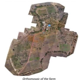
Read this use case to explore how Senegal Flying Labs applied drone technology for documenting and mapping of the boundaries of the farm and its current state to apply for and eventually obtain a land certificate.

Discover the use case
Download

