Skip to content

Empowering Mozambique with drone technology and data intelligence
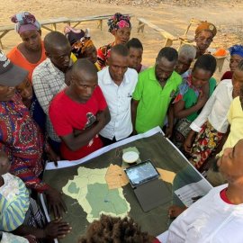
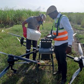
Mozambique Web Community Engagement Project 1 Mozambique Web Crop Spraying Project

About

We harness drone technology and data intelligence to drive innovation, sustainability, and social impact in Mozambique.

Our work brings together strategic collaboration between local stakeholders to harness cutting-edge technology and geospatial applications to drive innovation. We empower communities, researchers, and decision-makers with actionable data for better natural resources management, disaster response, agricultural productivity, and urban planning. We aim to bridge the gap between technology and local expertise for a smarter and more resilient Mozambique.

You will need to give cookie consent in the Experience option to see this video. Click the cookie link at the bottom right of the page to change your preferences.


Services

We provide drone-based data collection, mapping, and analytics for natural resources management, disaster response, agriculture, urban planning, and biodiversity conservation. We offer training, capacity building, and geospatial intelligence solutions to drive impact. By equipping local actors with practical skills and access to emerging technologies, we empower them to make more informed, data-driven decisions that support sustainable development and community resilience. Our goal is to strengthen local ecosystems by promoting the responsible use of technology, encouraging peer-to-peer learning, and co-creating solutions that drive meaningful impact at the community level.

Icon of a person standing and presenting to a group

Local Capacity Building

We provide hands-on training and knowledge transfer in drone technology, geospatial data analysis, and artificial intelligence (AI), tailored to the unique needs of local communities. Our programs are designed to build the technical capacity of professionals, students, and organizations across sectors such as agriculture, disaster response, health, and urban planning
Icon of a brain

Knowledge Exchange

We facilitate knowledge exchange through tailored training sessions, interactive workshops, and collaborative research initiatives focused on drone technology, geospatial data, and artificial intelligence (AI). By bringing together local experts, institutions, and community stakeholders, we create inclusive learning environments that foster practical problem-solving.
Icon of a drone

Sector Applications & Projects

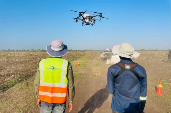
We deploy drones and geospatial analytics to deliver actionable intelligence across key sectors: crop‑health mapping for smarter agriculture; wildlife and habitat monitoring for conservation; rapid situational maps for disaster response; 3‑D city models for urban planning; and detailed orthomosaics and elevation data for infrastructure projects.
Icon of megaphone

Advocacy & Policy Support

We build a vibrant local ecosystem by convening government agencies, universities, businesses, and community groups around shared challenges. Through networking events, co‑creation workshops, and open‑data initiatives, we spark partnerships that turn drone‑collected insights into practical, sustainable solutions.
Icon of megaphone

Advocacy & Policy Support

We support legislators, ministries, and civil‑society coalitions with clear geospatial insights, such as flood‑risk maps for disaster bills, deforestation snapshots for climate budgets, and land‑use models for zoning debates—we strengthen the case for progressive, data‑driven action. Our team also co‑hosts policy roundtables, briefs parliamentary committees, and provides technical support to enhance drone regulations.
Icon of atom symbol

Youth/STEM Programs

We spark the next generation of tech leaders through immersive, project‑based STEM programs. Students aged 12–25 dive into the full innovation cycle—planning drone missions, collecting and visualizing geospatial data, building and coding robots, and experimenting with beginner‑friendly AI tools. In addition, our bootcamps, weekend hackathons, and after‑school clubs cultivate teamwork, critical thinking, and entrepreneurial skills
Icon of light bulb

Entrepreneurship Programs

We support entrepreneurship by equipping startups, youth innovators, and small enterprises with the tools and knowledge they need to succeed in the drone and geospatial sectors. Our program combines technical training in drone operations and data processing with business development support, including mentorship, market analysis, and guidance on building sustainable business models.
Icon of magnifying glass and checkmark inside it.

Assessments & Advisory

We offer data-driven assessments and expert advisory to help governments, NGOs, and private sector partners make informed, impactful decisions. By leveraging drone technology, geospatial analysis, and AI-powered insights, we deliver high-quality, locally relevant data that supports smarter planning and implementation.

Sustainable Development Goals We Focus On

  • E WEB Goal 01
  • E WEB Goal 06
  • E WEB Goal 08
  • E WEB Goal 09
  • E WEB Goal 10
  • E WEB Goal 13

News

Read our blog posts to learn more about trainings, process, community, and our field.


Team

A diverse team of experts and knowledgeable advisors with proven experience.

Antonio INGUANE 2024 1
Managing Director
António Beleza
Director of Corporate Strategy
Assane Pitoro
Operations Coordinator
Deyril Ibraimo
Operations Coordinator
Margarida Victor
Machine Learning Scientist
Jonas Macuacue
Airman Pilot (Pilav)
Stélio Matsinhe
WEB GIS Developer
Edna Manjate
Data Analyst
Renaldo Flor
Cartographer and GIS Technician
Jubilio Mausse
Data Analyst
Latifa Samuel
Community Engagement Specialist

Partners

Collaboration and support partners.

Mozambique Flying Labs ADE Mozambique Flying Labs Data Moz ING Mozambique Flying Labs AEROMAP Mozambique Flying Labs Data4 Angola

Where to Find Us

Mozambique Flying Labs
AEROMAP: Av Vladimir Lenine nr 2177 - 1º andar esquerdo, Maputo 2177, Mozambique

DATA4MOZ: R. do Barué, Condomínio da PAF, Cidade de Chimoio, Mozambique
Contact Us

Tell us more about you and how we can collaborate. We will get back to you shortly.

* Required