
Using Drone Technology to Assess Crop and Soil Health in Uganda
Uganda Flying Labs assessed the overall health of the crops and determined whether the soil in specific areas could support the growth of coffee and maize.
April 10th, 2025
By Nekesa Kitutu Rose, GIS & Drone Data Analysis Intern, Uganda Flying Labs
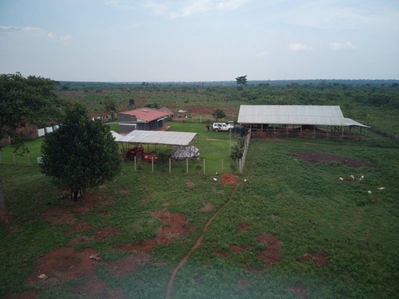
Who knew that what started as general mapping to determine land use and boundary delineation would evolve into investigations for crop and soil health? In February 2025, Uganda Flying Labs visited Riziki farm to conduct crop and soil analysis, flying over key sections of the land to collect aerial data. This farm is located on a generally waterlogged piece of land in Mazzi, Luwero District. The purpose of this project was to support the farm owner in understanding the condition of his crops and soil and, more importantly, to identify the best areas on his farm suitable for coffee and maize cultivation.
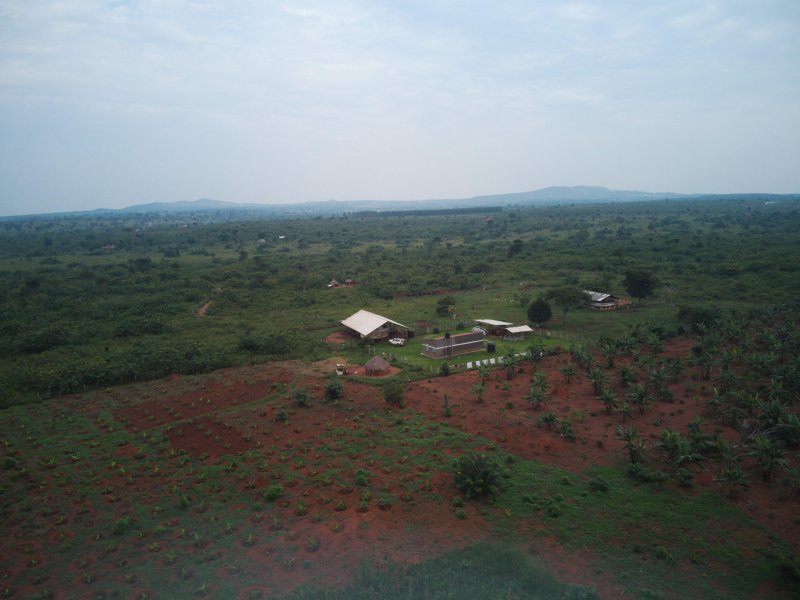
Collecting aerial data
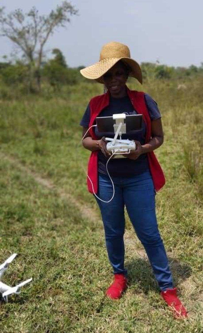
To perform the assessment, we used a DJI Phantom 4 multispectral drone, purposefully designed for precision agriculture work. Knowing that we were sampling, we simply created mission plans on-site and flew over the sample areas: two pineapple gardens and a swampy area where some shrubs had begun to grow naturally. We did the mission planning with Ground Station Pro. It was such a hot day that we kept running back to the car to cool down the iPad. This kept us on the edge because in those moments it was difficult to see the drone due to signal loss. Oh, what a relief it was when we successfully completed the missions!
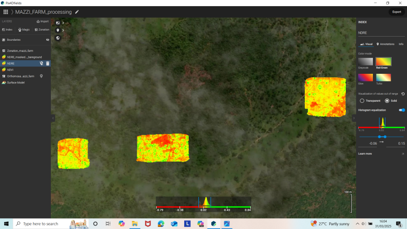
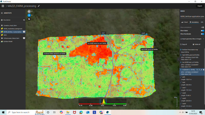
Using Pix4Dfields, an agricultural mapping software, we processed the drone imagery and generated NDVI and NDRE indices. These indices allowed us to assess the overall health of the crops and determine whether the soil in specific areas could support the growth of coffee and maize crops.
Findings from the field
The results were revealing. Our analysis showed that all sample areas were under stress due to:
- Severe nutrient deficiency in the soil
- Persistent waterlogging caused by the marshy nature of the land and the soil type
The poor state of the few shrubs and barely surviving pineapples matched what we saw in the NDRE maps, areas with very low vegetation health and limited potential for nutrient-hungry crops like coffee and maize.

From coffee to eucalyptus and elephant grass
After reviewing the results, the farmer expressed his appreciation and made the decision to adjust his initial farming plans. Instead of coffee and maize, he now intends to plant eucalyptus trees and elephant grass in the waterlogged parts of the farm, which are better suited to the existing conditions.
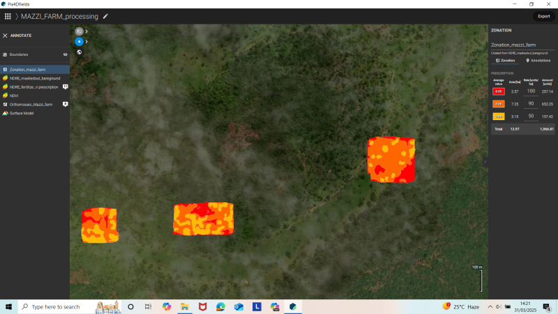
With the same software, we also helped him calculate a prescription for fertilizer application, based on Nitrogen deficiency in most of the soil, so he could begin restoring soil fertility in the most affected zones. However, as we were having this conversation, we realized that the waterlogged nature of the soil would inhibit the anaerobic bacteria that play a huge role in nutrifying the soil.
“This is very helpful. I now know where to invest my money—and not waste resources trying to grow crops in the wrong place.”
— Farmer, Riziki Farm
What’s next?
Encouraged by the outcome, the farmer has invited our team back for a second round of assessments, this time including new sections of the farm and collecting soil samples for laboratory testing to complement the drone data.
I gained valuable experience working on this project, especially in the practical application of tools like PIX4Dfields in soil analysis. It was exciting to see how data-driven farming decisions can have a real, positive impact on farmers.
Technology meets agriculture, and the result is smarter farming—rooted in data, not guesswork.
Category(s)
Recent Articles
View All »

Wildfire Assessment and Web Application in Sao Paulo
