By Nepal Flying Labs & Bhutan Flying Labs
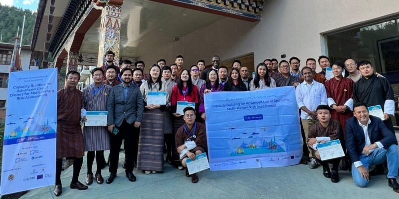
From a global perspective, drones are transforming disaster management, and Bhutan has also begun to embrace them. The "Capacity Building for Advanced Use of Drones for Multi-Hazard Risk Assessment Training" program occurred in Thimphu, Bhutan, from May 15 to May 26. There were a total of 30 participants in the training program, representing nine government implementing agencies (IAs), including the Department of Local Governance and Disaster Management (DLGDM), Department of Human Settlements, Department of Surface Transport, Department of Infrastructure Development, Bhutan Construction and Land and Transport Authority (BCTA), National Center for Hydrology and Meteorology, GovTech, National Land Commission Secretariat, and the Department of Geology and Mines (DGM). The training was organized as part of the "Strengthening Risk Information for Resilience Project" project aimed to enhance the Royal Government of Bhutan's (RGoB) risk-informed decision-making and development planning capabilities. The "Capacity Building for Advanced Use of Drones for Multi-Hazard Risk Assessment Training" program was pivotal as part of the same project. Three countries, NAXA and NFL, Nepal, Tara UAV, India, and BFL, Bhutan, collaborated and aimed to equip Bhutan with the necessary tools and knowledge to make informed decisions and enhance its resilience in the face of natural hazards. Let's explore the key highlights of this groundbreaking initiative.
Bhutan, a country exposed to various natural hazards such as floods, landslides, cloudbursts, glacial lake outburst floods (GLOF), earthquakes, wildfires, and droughts, faces significant risks to its infrastructure and assets. Over the past decade, natural disasters have resulted in damages exceeding $75 million. Additionally, the urban population is projected to rise from 37.8 percent in 2017 to 56.8 percent by 2047, increasing the vulnerability of both urban and rural areas to flooding. Given these challenges, resilient and sustainable infrastructure planning becomes crucial for Bhutan's growth. Recognizing this, the RGoB and the World Bank joined forces, signing a $4.2 million financing agreement to strengthen risk-informed decision-making and development planning in three different sub-components of the project. The project comprises three components: Component A, which included developing and piloting a multi-hazard risk decision support system. Component B focused on Strengthening Hydromet and Agromet Services Delivery, and finally, Component C discussed the Professionalization of the Construction Industry for Green and Resilient Infrastructure Development. This training was conducted as a part of component A, which focused on developing the participants' skills in piloting drones during various possible hazards and disasters.
The training program was designed for ten days in Thimpu. The program was then divided into three phases, where the participants were allowed to explore, find out, and utilize the full potential of drones in risk management. Overall, the training program started by giving the participants the basic theoretical and practical knowledge of drones and ended with the participants being able to bring out the best in drones through data processing, mapping, and analyzing risks.
The training syllabus was co-designed with the participants and input from the World Bank and the RGoB to ensure that the training schedule was equally accessible and easy to attend for all the participants. Co-designing with the RGoB also allowed the training team to be aware of the drone flight policies of Bhutan.
The training was comprised of both theoretical and practical learning sessions, as well as field-based and computer-based exercises. The training began with an introduction to drones, flight operations, and regulations, as well as information about risk management and developing skills in drone handling. The training covered drone photogrammetry, data processing, and mapping techniques. The training focused mainly on using drones for multi-hazard risk assessment, particularly for floods and landslides.
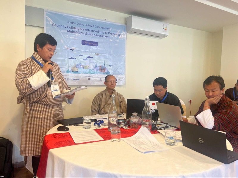
Commencing the program the first phase of the training program spanned four insightful days. The initial two days focused on theory-based sessions and online modules, diving into critical drone knowledge, Bhutan's 2017 Unmanned Aircraft Regulations, airspace concepts, aerodynamic fundamentals, decision-making, and risk management. Moreover, participants actively explored weather considerations and data privacy aspects. They also engaged in drone flight simulation exercises to ensure a cautious approach, effectively mitigating potential risks to valuable drone equipment. They were prepared to embark on practical field exercises with this solid grounding. They were equipped with the expertise to effectively assess multi-hazard risks and contribute to Bhutan's development planning and decision-making processes using drones.
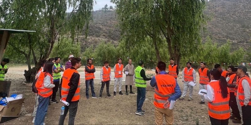
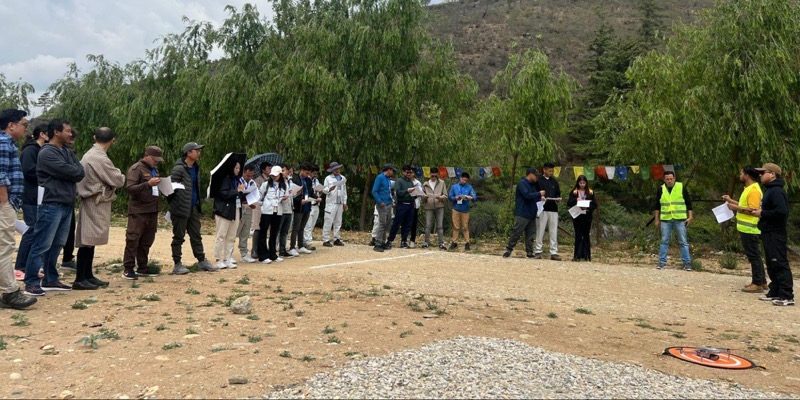
With the participating agencies combined efforts and expertise, Bhutan is embracing the drone revolution, leveraging its potential for comprehensive risk assessment and development planning, and reinforcing its commitment to building a resilient and informed nation. The participants went into the field to gain real-time flight experience to complete the second training phase. The use of drone simulators helped the participants in the field by boosting their confidence during flight training. The participants engaged in more than 20 maneuvers to reinforce their abilities and embrace their flight skills and experiences.
To harness the power of drone data, participants dedicated their efforts to enhancing their practical skills in utilizing drones for risk assessment and development planning by going into the field. This crucial period focused on advanced topics like photogrammetry, mission planning, mapping, and data processing. The participants immersed themselves in the intricacies of photogrammetry, mastering the art of capturing precise aerial imagery and transforming it into valuable 3D models and measurements. During this training program phase, participants focused on honing their mission planning skills to organize and execute drone flights effectively. They explored mission planning software and optimized flight paths, considering factors like flight duration, altitude, overlap, and safety protocols. This careful approach equipped them with the expertise to acquire high-quality drone data.
They familiarized themselves with data processing and analysis techniques, integrating ground control points (GCPs) to enhance measurement accuracy. Participants learned real-time kinematic (RTK) and post-processed kinematic (PPK) techniques, leveraging satellite positioning for precise drone positioning during data collection. By implementing these advanced techniques, participants aimed to achieve higher accuracy in their drone-derived data, ultimately enabling more reliable risk assessments and development plans. They familiarized themselves with cutting-edge software and techniques that facilitated the accurate reconstruction of topographic features, which proved invaluable for assessing hazards and planning development initiatives. The training program concluded with intensive sessions during its final three days, focusing on the practical application of drone technology in flood and landslide risk assessment. Participants were allowed hands-on learning experiences, honing their skills in analyzing drone-captured datasets and developing comprehensive hazard maps. They gained invaluable knowledge by utilizing various tools and techniques to assess risks and make informed decisions. By integrating drones into their risk assessment practices, the participants were equipped with the necessary expertise to contribute to more effective risk management strategies and enhance the resilience of Bhutan's development planning. Understanding the significance of multi-hazard risk assessment, participants explored the application of drones in flood and landslide risk evaluation. The training covered essential terminology, demonstrated the creation of landslide susceptibility maps using freely available datasets, and provided hands-on learning on various tools to develop landslide susceptibility and flood hazard maps. Participants were also offered drone-captured datasets, enabling them to employ practical techniques for risk analysis.
The training program provided valuable insights and lessons for future endeavors. One important lesson learned was the need for adequate time allocation and customization of training content based on participants' backgrounds and expertise. The diverse qualifications of the participants highlighted the importance of dedicating more days or separate thematic training sessions to ensure effective knowledge transfer. Additionally, the engagement of participants was found to be significantly higher during in-person sessions compared to online sessions, emphasizing the preference for hands-on, practical learning experiences. Providing advanced study materials before the training enhanced participants' understanding and engagement during the in-person sessions. Furthermore, the involvement of local partners and organizations was instrumental in efficient logistics management, language support, and the overall engagement of participants. Prioritizing safety and risk management education, collaboration among organizations, and flexibility in course content were other essential lessons from the training program.
Based on the lessons learned, several recommendations can be made to improve future training programs on drone usage for risk assessment. Firstly, it is advised to purchase the enterprise version of the drone flight simulator software to develop the flight skills of beginner participants. The enterprise version will also enable the host, or in this case, the NFL, to have better control over hosting the training program in the future. This will also ensure a comprehensive understanding of the subject matter and allow participants to acquire the necessary skills effectively. Another recommendation for Bhutan is to provide a "drone corridor" provision, enabling students and participants to learn and enhance their drone flying skills whenever they want. This can be achieved by obtaining permissions for designated training areas and facilitating access to simulators for regular training sessions.
Additionally, developing a comprehensive online theory training course, accompanied by supervised in-person testing, can reduce training time and costs while ensuring the fidelity of the learning process. The training team also suggests the implementing agencies in Bhutan develop a UAS management enterprise strategy to effectively track, maintain, and manage the growing drone fleet across implementing agencies. Furthermore, the Bhutan Government offices must have access to open-source software, making it easier to customize the software as per our needs and the requirements of future training sessions. Finally, establishing a centralized data storage and management system and fostering a data-sharing culture will facilitate effective collaboration, knowledge exchange, and easy use of data by different organizations for improved risk assessment and disaster management practices in Bhutan.


