Pakistan Flying Labs at Aerothon Drone Tech Expo NUST 2025
Drones, Data and AI for STEM / Youth | January 15, 2026
The teams impressed the audience with demonstrations that truly reflected the spirit of innovation and excellence.
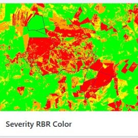
Enabling rapid and accurate wildfire assessment through satellite imagery
November 26th, 2025
Brazil Flying Labs carried out a project that enables rapid and accurate wildfire damage assessment through automated processing of Sentinel-2A satellite imagery. Providing ready-to-use environmental data via API and web dashboards to support decision-making and reduce costs and response times. Due to the success of the pilot phase, the next steps of the project will focus on scaling implementation, deepening institutional integration, and advancing technological capabilities to maximize both impact and long-term sustainability.

Discover the use case
Download

