AfriGEO 2025: How Senegal Flying Labs is Helping Shape Africa's Geospatial Future
The symposium emphasized that geospatial intelligence must be accessible to everyone—governments, scientists, local communities, and especially young people.
November 25th, 2025
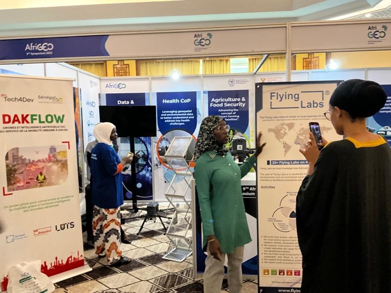
Senegal Flying Labs proudly joined leading geospatial stakeholders from across the continent at the 9th AfriGEO Symposium 2025, hosted in Senegal under the central theme: “From Data to Impact: Strengthening Africa’s Geospatial Future.” This event gathered high-level policymakers, researchers, practitioners, and innovators to explore how geospatial intelligence—powered by Earth observation, drones, and advanced analytics—can drive sustainable development and resilience across Africa. Our participation reflects our continued commitment to building local capacity, advancing applied research, and demonstrating the transformative power of geospatial technologies for communities.

Event Highlights
A major highlight of the symposium was the GEOGLAM training on integrating satellite and in-situ observations for agricultural monitoring. This session tackled one of Africa’s most urgent priorities: food security. Trainers demonstrated how combining satellite imagery with ground-level measurements enables robust monitoring systems that track crop health, predict yields, and identify early warning signs before failures occur.
This integration is critical because agriculture remains the foundation of livelihoods for hundreds of millions of Africans. Timely, accurate geospatial information can literally determine whether communities experience abundance or crisis.
The session also delved into how Earth observation supports decision-making in efforts to achieve Land Degradation Neutrality, a growing priority as climate stress and land overuse threaten both agricultural productivity and ecosystem health. Participants explored how satellite data can identify degradation patterns, pinpoint areas for restoration, and measure progress toward national environmental targets.
The symposium also spotlighted Digital Earth Africa, a powerful open-access platform offering continent-wide satellite data analysis tools without the need for heavy infrastructure or expensive computing. Trainers demonstrated how governments, researchers, and institutions can leverage this platform to analyse vegetation, water resources, land use, and atmospheric trends using long-term satellite data archives.
As Africa’s digital transformation accelerates, platforms like Digital Earth Africa are essential for democratising access to geospatial intelligence, ensuring that decision-makers at all levels can use data to inform development planning, climate adaptation, and environmental governance.

Senegal Flying Labs' Contribution
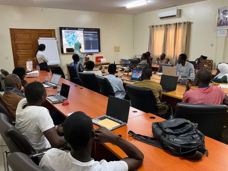
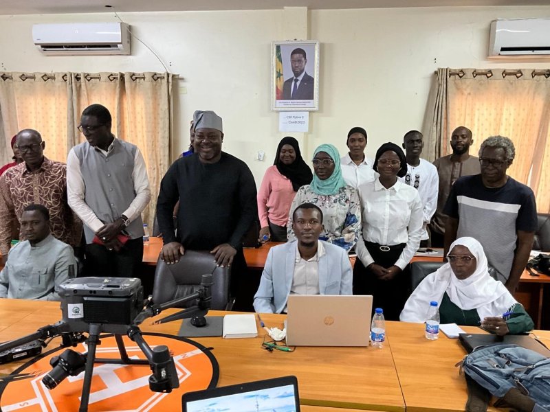
Senegal Flying Labs contributed directly to the programme by providing hands-on training in drone data processing. Our session showcased the growing importance of unmanned aerial systems (UAS) in complementing satellite observations through high-resolution, on-demand imagery. Drones are increasingly becoming essential tools in areas such as precision agriculture, disaster assessment, urban development, and environmental monitoring.
By equipping participants with practical skills in drone data acquisition and analysis, we reinforced our ongoing mission to build strong, local technical expertise and expand Africa’s geospatial capacity from the ground up.

The programme continued with sessions on open geospatial data for human settlements and innovative applications of Earth observation for air quality monitoring. The air quality segment, organised by the GEO Health Community of Practice Air Quality Working Group, highlighted a critical yet often invisible crisis affecting Africa’s rapidly urbanising cities.
Using satellite-derived pollution data, participants explored how geospatial tools can uncover pollution hotspots, inform health policies, and guide public interventions aimed at protecting vulnerable communities. These insights are becoming more essential as urban populations grow and environmental challenges intensify.
Our presence at AfriGEO 2025 reinforced the importance of collaboration, capacity building, and innovation in shaping Africa’s geospatial future. The symposium emphasized that geospatial intelligence must be accessible to everyone—governments, scientists, local communities, and especially young people. The call to action was clear: Africa must strengthen open data access, adopt emerging technologies, empower the next generation, and transform geospatial information into actionable development solutions.
At Senegal Flying Labs, we remain deeply committed to this vision. Through partnerships, training, research, and technology integration, we will continue working to ensure that Africa’s geospatial ecosystem is built on local expertise, regional collaboration, and impactful innovation.

From Data to Impact: The Path Forward
As AfriGEO 2025 drew to a close, the discussions and exchanges of the past four days converged into a clear reflection on where Africa’s geospatial community stands today—and where it must go next. The symposium made one reality unmistakable: the continent has moved well beyond the stage of debating whether Earth observation is important. The focus is now firmly on how to deploy these capabilities more strategically, more inclusively, and more effectively.
What emerged was the portrait of a geospatial ecosystem in full maturation—an ecosystem defined by increasing technical expertise, expanding institutional capacity, stronger regional cooperation, and a growing commitment to integrating geospatial intelligence into everyday decision-making. Across ministries, research centres, private sector actors, and community organisations, a shared belief prevailed: geospatial information is no longer a supporting tool; it is a critical driver of sustainable development.
The symposium’s call to action highlighted five interconnected priorities that will shape the continent’s geospatial trajectory in the years ahead.
- The need to reinforce open data access so that information flows freely to those capable of translating it into action.
- The transformation of data into meaningful insights, which requires sustained collaboration between data producers and the decision-makers who rely on their outputs.
- The strengthening of partnerships—across countries, sectors, and institutions—to pool expertise and resources.
- The embrace of innovation, particularly through artificial intelligence, cloud computing, and big data analytics, which can accelerate impact and help close Africa’s digital divide.
- The empowerment of the next generation, ensuring that young professionals and underrepresented communities have the training, opportunities, and support needed to lead Africa’s geospatial future.
As participants left Dakar, they did so with more than new knowledge and professional networks. They carried a renewed conviction that Earth observation and geospatial technologies are not ends in themselves—they are essential tools for addressing Africa’s most urgent challenges. Whether improving food security, supporting climate adaptation, enhancing disaster response, guiding urban development, strengthening public health, or protecting fragile ecosystems, the potential applications are as vast and diverse as the continent itself.
The message was clear:
Africa’s geospatial future will be defined not by the data it collects, but by the impact it creates.
Category(s)
Recent Articles
View All »

Team Cameroon's Road to Victory at the First Global Robotics Competition 2025
