Pakistan Flying Labs at Aerothon Drone Tech Expo NUST 2025
Drones, Data and AI for STEM / Youth | January 15, 2026
The teams impressed the audience with demonstrations that truly reflected the spirit of innovation and excellence.
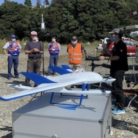
In-house Monthly Training for Disaster Response Mapping
January 12th, 2024
In this case, Japan Flying Labs and CrisisMappers Japan share details about their monthly technical training for professionals in the use of drones for disaster response mapping.

Discover the use case
Download

