Pakistan Flying Labs at Aerothon Drone Tech Expo NUST 2025
Drones, Data and AI for STEM / Youth | January 15, 2026
The teams impressed the audience with demonstrations that truly reflected the spirit of innovation and excellence.
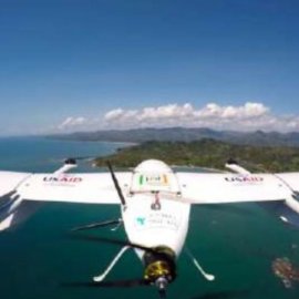
Serving More Than 150 Inaccessible Communities in the North of Madagascar
December 1st, 2020
In this use case, Madagascar Flying Labs shares their project experience of delivering antimalarial products using eVTOL drone to 150 supply points. These points act as intermediaries between the Population Services International (PSI) and the Community Health Workers (CHV).

Discover the use case
Download

