Reaching the Unreached: A Doctor’s Call for Equity
Drones, Data and AI for Health | December 10, 2025
Watch the documentary now to witness Philippines Flying Labs' work using drones to fight tuberculosis in remote communities.
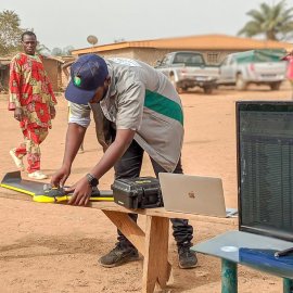
Drone technology for traceability and certification of cocoa cooperatives in Côte d’Ivoire
June 1st, 2020
Through this use case, Côte d'Ivoire Flying Labs shares their experience in using drone data to rectify errors in GPS delineation of cocoa farmers’ plot to improve traceability and assist them in becoming certified.

Discover the use case
Download

