Building the Skills of the Next Generation of Scientists in Drone Data Analysis and Interpretation
Benin Flying Labs trains 12 scientists from the Faculty of Agricultural Sciences at the University of Abomey-Calavi.
July 31st, 2019
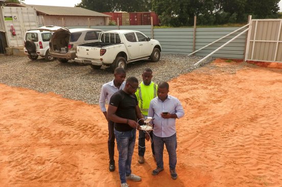
In its mission to build and strengthen local capacity in using robotics for good, Benin Flying Labs initiated a training series for local researchers. Previously, these trainings focused on how to fly and collect data using drones. Data collection is just one step in the process to generate actionable information from the data collected. Data analysis and interpretation represent the second critical part of the workload. Mastering the skills needed to analyze and interpret drone data is crucial for researchers, so as part of its 2019 working plan, Benin Flying Labs is working with researchers at the university to hone their data analysis and interpretation skills.
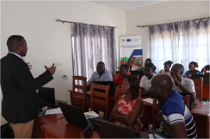
This training, held in May, was organized to benefit the members of the Laboratory of Genetics, Horticulture and Seed Sciences (GBioS) at the Faculty of Agricultural Sciences of the University of Abomey-Calavi. Twelve scientists and students of this laboratory participated.

The training was divided into three parts:
- Presentation of Benin Flying Flying Labs;
- The importance of drone use for smart agriculture; and
- Drone data analysis and interpretation.
After the presentation, several topics were covered during the second part namely:
- Crops irrigation and hydration analysis
- Fertilizers application on the homogenous area using Normalized
- Density Vegetation Index (NDVI) maps and other vegetation index maps
- Soil analysis using multispectral captors
- Use of final products of drones data in planning and managing cultural operations
The third part of the training was devoted to drone data analysis. Two sets of data were provided to the participants. The first set was collected using the classic captor of three bands (RGB) and the second set was collected using a multispectral captor. The participants used the trial versions of Pix4Dmapper et Pix4Dfields during the rest of the workshop. After this preparatory step, participants were taught how to use Pix4D fields to analyze the data. The learning of this specific software provided them with the opportunity to experiment with agricultural drones data, compute the appropriate index under different conditions, interpret them and maps the results.
After being equipped with this knowledge, the second software, Pix4Dmapper was then used to extend the works done with the previous software. The participants were able to compare the two software, their importance, and relevance in answering agriculture research questions.
At the end of the training, participants shared the research projects they are planning to implement with the drones. They want to use the technology on their experimentation fields in monitoring the fields. implementation and crop monitoring.
The training was a real success. The next training scheduled is the use of open-source software such as QGIS to analyze drone data. Watch this space for our next update.
This training is organized thanks to the technical support of Global Partners (GP) and the Agence pour le Développement du Numérique (ADN) and WeRobotics. Special thanks to the director of GBioS for their facilitation and contribution to the success of this training.
Category(s)
Location(s)
Recent Articles
View All »

Preserving Senegal's Mangroves: Aerial Mapping in Somone Marine Protected Area
