Mozambique Flying Labs Launches with Ambitious Goals
The team aims to transform the data, mapping, and geospatial intelligence ecosystem in Mozambique and the SADC region.
May 12th, 2025

Mozambique Flying Labs is thrilled to join the global Flying Labs Network. Born from the strategic partnership between two Mozambican startups, Data4Moz and AEROMAP, our team comes ready to impact the aerial mapping, data, and geospatial intelligence ecosystem not only in Mozambique but across the broader Southern African Development Community (SADC) region.
Mozambique Flying Labs is co-led by Antonio Inguane and Antonio Beleza, with technical coordination from Deyril Ibraimo (Data Analytics Coordinator) and Assane Pitoro (Aerial Mapping Coordinator). Our combined expertise anchors a mission to leverage cutting-edge technology such as drones, remote sensing, and data analytics to address critical challenges in areas like disaster management, agriculture, urban planning, transportation and mobility, environmental monitoring and biodiversity conservation.
By empowering local talent and building strong partnerships, we aim to develop homegrown solutions that are scalable, sustainable, and rooted in local community needs.

Among the projects through which we have built our expertise are the following.
Land Use Intensity’s Potential, Vulnerability and Resilience for Sustainable Agriculture in Africa (LUISA) (May 2024 – present)
LUISA is a 24-month research project being conducted in a consortium with Boku University (Austria), University of Twente (The Netherlands), and European Spatial Agency (ESA) with the aim of developing a remote sensing-based platform to measure biomass along the African continent to serve as a source of spatial data and provide subsidies basis for monitoring forest loss across Africa.
Community-led natural resources management through participatory spatial data (April 2024 – January 2025)
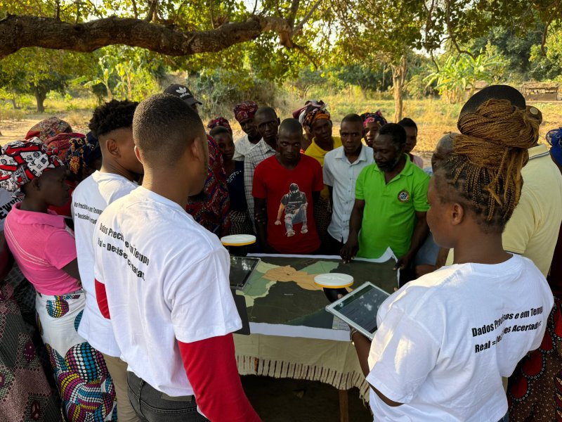
The project aimed to empower community members from the Gorongosa – Marromeu landscape in the use of geospatial data for the management of their natural resources. This included identifying, mapping, and reporting wildlife crimes, especially poaching, through the use of mobile devices and aerial images to generate and apply localized data.
As a result, 50 members from 5 communities were trained and are using spatial data in their day-by-day, contributing to the better management of the local natural resources in the communities.
The success of the project was largely due to the strategic structuring and temporal distribution of the training content, which allowed for good technological adoption by the beneficiaries.
Participatory coastal resource mapping in the greater Bazaruto Key Biodiversity Area (September 2023 – April 2024)
The project focused on applying local communities' knowledge to generate spatial data and participatory maps on the occurrence of coastal resources in the Bazaruto Key Biodiversity Area (KBA). This was through mapping the areas of greatest importance for the conservation of coastal biodiversity.
This project culminated in the creation of a robust database of coastal resource distribution from the community perspective.
The success of this work was due to engagement with the communities and the in-depth knowledge of the region of the community members.
Aerial mapping with drones
We have carried out several aerial mapping projects using drone technology. Among these, the following are worth highlighting:
- In October 2023 we mapped an area of around 250 hectares, the central aim of which was to obtain high-precision data for the purposes of land preparation and drainage system configuration for sugar cane production fields.
- In 2024, we carried out mapping using drone technology in rice production fields in the province of Sofala in the district of Chemba, the aim of which was to create a general digital terrain model for the purposes of collecting water resources from the river to the fields and configuring the drainage system for the fields.
- In 2025, we carried out a project to map a solar station in the province of Cabo Delgado, Ancuabe district.
- As part of social responsibility, we are taking part in a project by Save The Children International and the Ministry of Agriculture, Environment and Fisheries. The project entails the mapping of water sources and the application of GIS tools to analyze the distribution of the supply system and identify areas with any deficiencies. It will cover a total of 9 districts in 3 provinces: Gaza, Sofala and Tete.
Precision agriculture
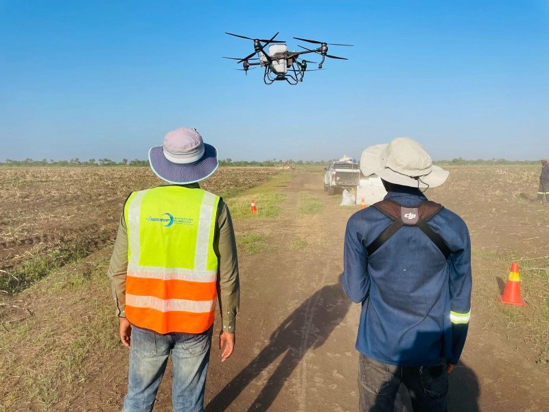
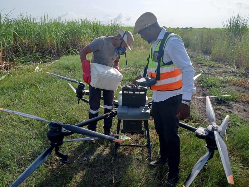
With regard to precision agriculture using drone technology, we have extensive experience in applying agricultural inputs, spreading seeds and fertilizers and inspecting fields. From 2023 to 2025, we conducted application for 18,000 ha in sugar cane fields in Tongaat Mafambisse, Xinavane, and Companhia de Sena. We have also done the same for maize, rice, banana, mango, and other crop fields. In addition, we also have experience in spreading/seeding. In 2024 alone, we spread around 6 tons over an area of more than 300 ha in the fields of Tongaat in Xinavane and Companhia de Sena in Marromeu.

Beyond merely utilizing emerging technologies, Mozambique Flying Labs hopes to contribute to a local ecosystem of innovation that puts data and geospatial intelligence at the service of people and the planet. As part of the global Flying Labs Network, we look forward to combining our local expertise with global collaboration for a more sustainable future for Mozambique.
Category(s)
Location(s)
Recent Articles
View All »

Team Cameroon's Road to Victory at the First Global Robotics Competition 2025
