WATCH: Building Community Resilience through Hydro-agricultural Development
For our Turning Data Into Action project, Burkina Faso Flying Labs demonstrated the value of drone technology as a tool for topographic survey.
July 26th, 2024
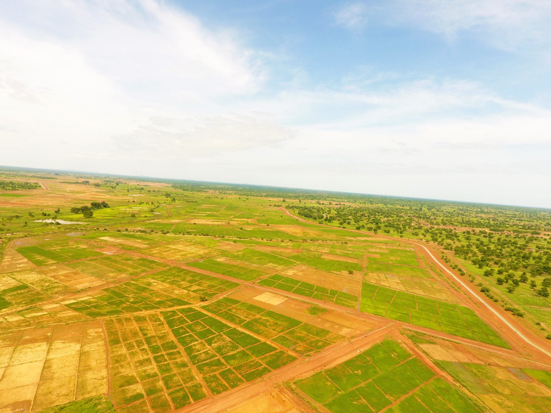
 Soum Irrigation Scheme
What does it mean to use technology to strengthen the resilience of our communities?
For Burkina Faso Flying Labs, hydro-agricultural development has proved to be one answer. Supported by WeRobotics’ Turning Data Into Action program, we worked to demonstrate the value of drone technology as a tool for topographic survey and farm advisory services. Working hand in hand with Projet de Développement Hydroagricole Soum (PDHS), which developed an irrigation scheme covering more than 1,000 hectares in the village of Soum, we were able to carry out the topographic survey with drones faster and with fewer resources. In a country where agriculture – a large part of the economy – is under great threat thanks to climate change, this was a huge step forward on the road to making food production as profitable and sustainable as possible.
Featured in Forbes, our project benefited more than 5,000 rural households, showcasing that agriculture based on a water management system is crucial to the socio-economic development of communities in Burkina Faso. In the video below, we narrate how our efforts to use drones to manage and develop irrigated schemes tie into our overall mission to improve socio-economic resilience in communities.
Beyond fortifying the resilience of local communities, this project transformed our team’s resilience as well. In an impact story by WeRobotics, Claudel Guiella, Burkina Faso Flying Labs’ Coordinator, counts the experience as a valuable lesson that turning data into action takes time, and if we are to create change that lasts we must be willing to keep trying even in the face of intimidating hurdles.
With local expertise and technological innovation we can build thriving communities, and as Burkina Faso Flying Labs, we remain eager to play our part in harnessing these tools to enhance local capacity to withstand and recover from adverse conditions.
Category(s)
Location(s)
Recent Articles
View All »

Team Cameroon's Road to Victory at the First Global Robotics Competition 2025
