
Mauritania Flying Labs Joins the Network
Flying Labs Network | July 20, 2026
The establishment of Mauritania Flying Labs creates a platform for long-term innovation, responsible technology use, and sustainable development impact.
Ghana Flying Labs' topographical survey supports the engineering design and construction of the Bechem–Akumadan Road.
May 20th, 2024
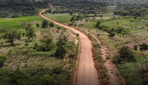
In our part of the world, where roads are a vital cog in nationwide development, particularly in the agricultural sector, towns like Bechem, Dwommo, Techimantia, and Subriso are typical of many rural communities. Here in Ghana, agriculture sustains livelihoods, and small-scale businesses drive economic activities.
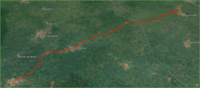
The Bechem–Akumadan road, which serves these towns, was in a deplorable state, causing traffic congestion and hindering the transport of farm produce to neighboring villages. This necessitated its reconstruction. An agreement was signed between Medici Land Governance – a public benefit company that uses technologies to provide user-friendly, low-cost land administration systems – and Rango Construction Limited to reconstruct the Bechem–Akumadan Road (R-066), a total length of 40 kilometers. Located in the Ahafo region, this road links Bechem, Dwommo, Techimantia, Subriso, and other townships to the Kumasi–Techiman Highway. Subsequently, another contract was signed between Rango Construction and Ghana Flying Labs (SKT Live) to undertake a mapping project for topographical services essential to the road's reconstruction.
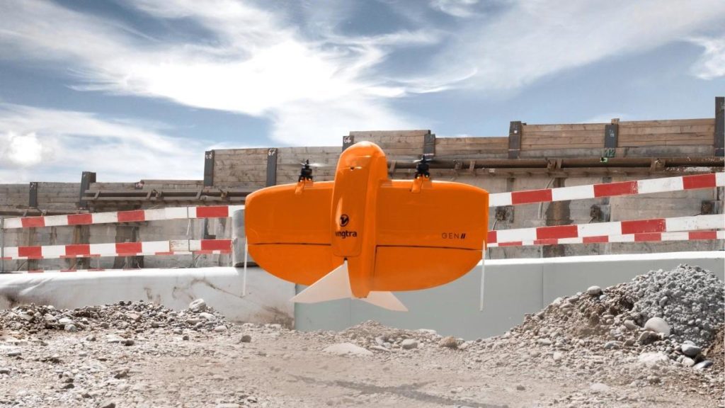
You might wonder how Ghana Flying Labs achieved this using RGB and LiDAR scanning with Wingtra One and Yellowscan Mapper mounted on a DJI M300 drone. Here's how the process unfolded.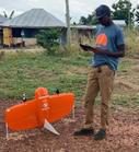
Prior to the start of the survey, we extracted the coordinates of the ground controls from previous survey data. We also extracted the centerline of the new road alignment from the geometric design provided by Rango Construction. This new alignment was used in planning flights for both the Wingtra and DJI M300 drones.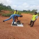
After site reconnaissance, the team began the aerial survey. We used the WingtraOne, a drone equipped with Post Processing Kinematic (PPK), for area mapping. Three of the ground control points served as base stations for the flight. About 90% of the corridor was scanned with a LiDAR scanner (Yellowscan Mapper II), producing ground points to generate contour and Digital Terrain Model (DTM) for the existing road surface.
The base station was set on selected control points for the flight, as the YS Mapper uses GPS base data to post-process the LiDAR scanner's trajectory. The team also placed Ground Control Point (GCP) markers and observed them for 20 minutes on the ground to check the flight output results after processing. Two GCP markers were placed during each flight to serve as a check for the aerial survey.
 The successful execution of this project has resulted in the production of a topographical map, a new volume report, a volume analysis, a longitudinal profile, and a cross-section at 25-meter intervals for the Bechem–Akumadan road.
By leveraging the precision and efficiency of RGB and LiDAR scanning, the collaborative efforts of Medici Land Governance, Rango Construction Limited, and Ghana Flying Labs are not only improving a critical transportation route but also setting a precedent for future developments in Ghana’s rural areas. This project highlights how innovative solutions can effectively address longstanding challenges, nurturing economic growth and improving the quality of life for local communities.

