
A New Chapter for Nigeria Flying Labs
Impact Story | May 22, 2026
Their work has demonstrated the important role that emerging technologies can play in agriculture, education, and disaster resilience.
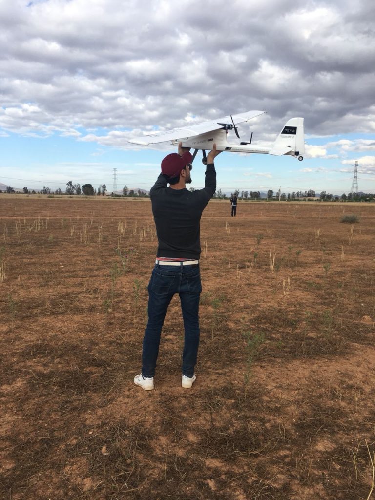
Morocco Flying Labs performed a pilot mapping project to assess the feasibility and performance of mapping BVLoS up to 40km from the ground station.
February 17th, 2020
By Jamal Berrich, Morocco Flying Labs
Every winter, families in remote villages in the Atlas mountains of Morocco live through many hardships. While Morocco has one of the most developed infrastructures in Africa, its geology poses serious challenges to connect with populations living in remote areas. For instance, seventeen percent of Moroccans still don't have access to drinking water.
Morocco Flying Labs, in partnership with ATLAN Space and a civil engineering company, performed a pilot mapping project by the end of 2018. The pilot aimed to assess the feasibility and performance of mapping BVLoS (Beyond Visual Line of Sight) up to 40km from the ground station.
The main objectives were:
Flight BVLoS can be unsafe using current flight controller technologies. Morocco Flying Labs conducted a risk assessment, obtained necessary authorizations, and coordinated with local authorities in the area of Ain Sfa in Eastern Morocco where tests were to be performed.
ATLAN Space provided it's ATLAN Core AI technology to handle safe path planning and autonomous behavior in low bandwidth connections, and dynamic weather and random terrain. Some risks were identified, and the challenges faced helped better forge AI and its safety features and procedures.
The drone used was a small custom-built drone with a 2m wingspan airframe from Volantex Ranger Ex 757-3. It provides a flight time of 60-120min at 54km/h cruise speed. In terms of performance, mapping speed was established at 192ha per hour at 1.17cm/px horizontal and less than 5cm vertical accuracy. Post-processing in ATLAN Space local server was estimated at a rate of 64ha per hour though it can be improved by increasing processing power.
Most difficulties were related to takeoff and landing, logistics, and weather. It wasn't easy to identify a flat clearing fit for landing. The terrain was sandy, mostly blocking landing gear, forcing us to use a combination of regular and deep stall landings. Roaming livestock presented a real challenge that required enhancement of pre-landing procedure and AI behavior. Ain Sfa also was an interesting site with moving thermals after mid-day that continuously change wind direction and speed.
On the bright side, the pilot results were very positively received by the civil engineering company. The speed, accuracy, flexibility, and added AI safety of the solution are a real game-changer. The output was tested and successfully included in existing processes and workflows.
The next steps remain challenging as this solution needs momentum to reach decision-makers in Morocco, where the use of drones still has a negative perception. However, Morocco Flying Labs will do its best to push the positive and safe use of drones. The gain in performance is astounding at a fraction of the cost of other solutions. If it's used by local actors to fulfill local mapping and survey needs of a remote area, this solution can accelerate infrastructure planning and development to the benefit of isolated Moroccan populations.

