 Source: OSRC, Akure, Ondo State
By Nigeria Flying Labs
In the wake of the 2023 wet season, residents found themselves grappling with the aftermath of devastating floods that wreaked havoc on lives and property across major urban and rural communities in Ondo State. The floods disrupted businesses, agriculture, infrastructure, and local economies. As the effects lingered, the pressing need for a robust response to such crises became evident. Recognizing the need to utilize data for efficient public sector service delivery during humanitarian disaster response, Nigeria Flying Labs launched a pivotal project as part of WeRobotics' Turning Data into Action (TDIA) program, which is designed to strengthen local capacity to apply robotics, data, and geospatial intelligence for sustainable social impact.
In this blog post, we delve into the details of this project, shedding light on our objectives, methodologies, results, and the potential impact it holds for building a resilient future for Ondo State.
Approach
The objectives of the TDIA program informed our stakeholder engagement process, thus creating an opportunity to engage with the Ondo State Environmental Protection Agency (OSEPA). These engagements were essential in aligning efforts and resources, ensuring not only the effectiveness of the project but also the sustainable implementation of a data-driven approach to disaster management and enhanced decision-making.
Capacity building is another critical aspect that we prioritized. Nigeria Flying Labs conducted a two-day certified training session on drone operation and GIS for disaster management, equipping OSEPA staff with the necessary expertise. This capacity-building was foundational for the mission's success.
For the fieldwork, we used the DJI Phantom 4 drone, renowned for its reliability and performance and its 1/2.3-inch CMOS, 12-megapixels sensor. This enabled us to get high-quality imagery and detailed mapping crucial for flood assessments. We conducted our flights systematically, adhering to a strict protocol, with meticulous planning to ensure both safety and accuracy.
We utilized the DJI GO mobile app designed for flight planning and data collection. The app enabled us to monitor the drone's path, capture real-time images, and store critical data.

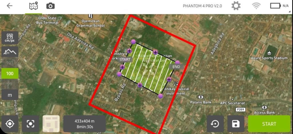
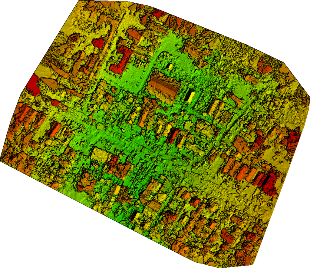
After the flights, the data collected was processed to generate DTM (Digital Terrain Model), DSM (Digital Surface Model), Orthomosaic map, and contour. The processed data allowed us to conduct a disaster vulnerability assessment, identifying households and businesses at risk of flooding in the upcoming wet season in 2024.

We conducted a pilot autonomous drone flight over flood-prone areas, showcasing how aerial intelligence and geospatial information could provide actionable insights for decision-making, particularly in drainage clearing efforts.
To enhance reporting and data visualization, Nigeria Flying Labs has also documented this project in an interactive ArcGIS Story Map.
Objectives and Deliverables
For this project, we had a set of clear objectives and impactful deliverables aimed at developing sustainable solutions and aiding informed decision-making:
- To achieve enhanced emergency response capabilities by building the capacity of OSEPA, enabling faster and more informed decision-making during disaster events.
- To enhance the capacity of OSEPA to conduct aerial surveillance for better assessment of the extent of damage, identification of critical infrastructure, and evaluation of potential hazards.
- To empower OSEPA personnel to conduct rapid damage assessments using drones. By capturing high-resolution imagery and videos of affected areas, trained operators can quickly assess the severity and extent of damage, helping to prioritize response efforts and allocate resources efficiently.
- To provide improved capacity to create accurate maps and geospatial data using drone imagery, enabling better planning, resource allocation, and decision-making during emergencies.
- To enhance proficiency in analyzing drone-captured data and generating comprehensive reports.
- To enhance safety and legal compliance among OSEPA personnel, ensuring safe and responsible drone use during emergency response activities.
- To foster networking, knowledge exchange, and potential partnerships, creating a supportive ecosystem for ongoing learning and collaboration.
Stakeholder Engagement
The cornerstone of Nigeria Flying Labs’ disaster management strategy is its collaborative engagement with stakeholders. Recognizing that the involvement of all relevant stakeholders, from government agencies to local communities, is pivotal in tackling the flood crisis, we engaged with the Office of the Ondo State Deputy Governor, OSEPA, and the Ondo State Emergency Management Agency.
Through thorough stakeholder analysis, we identified and leveraged the strengths and expertise of our partners. This allowed us to create targeted and efficient disaster management strategies, ensuring that each stakeholder's role aligned with the overarching goal of flood mitigation.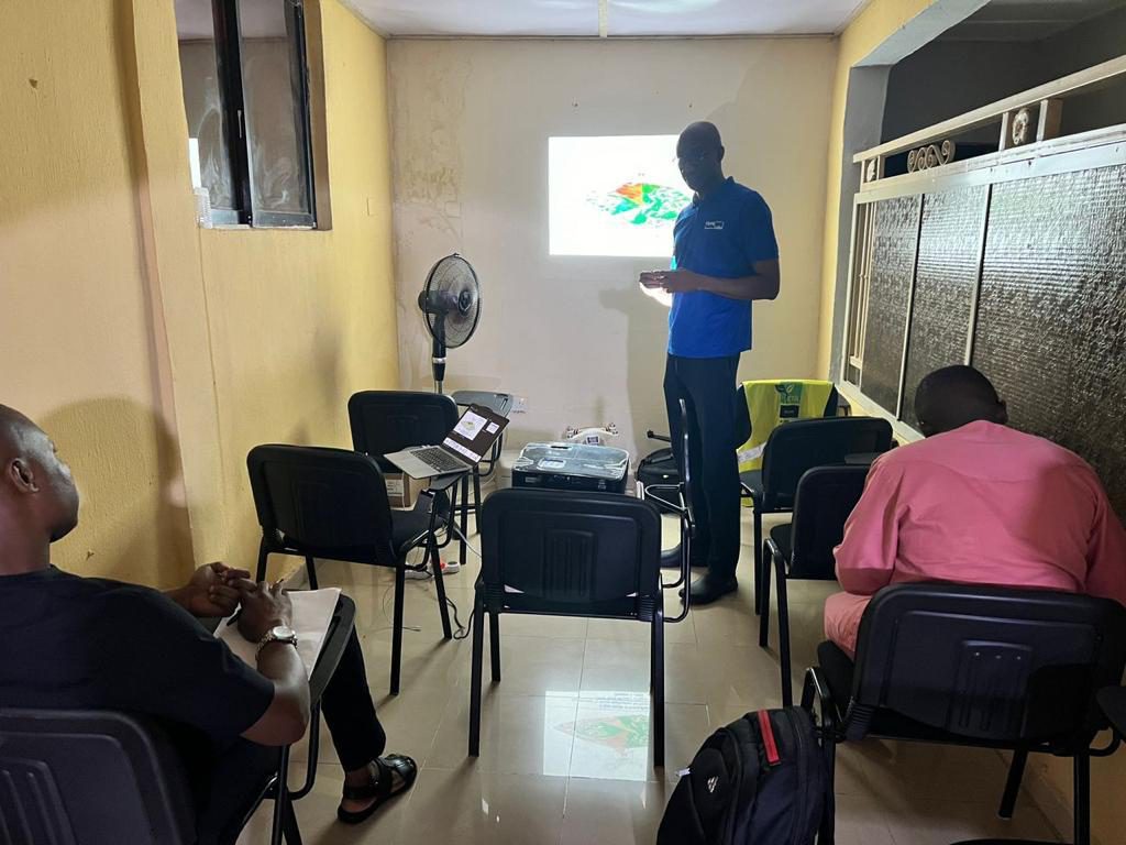
OSEPA identified two key technical personnel who possessed the technical expertise required in the context of training trainers. The personnel were championed and led by the Ondo State Special Adviser on Environment, who approved a comprehensive capacity-building program for the participants, who are the OSEPA staff in charge of the Operation Flash Flood work plan.
Challenges
The capacity building activity was in the middle of a cabinet reshuffle and would be affected by the interest and influence of the selected head of OSEPA. Nigeria Flying Labs mitigated this constraint by holding informal meetings with the selected Special Adviser to the Ondo State Governor on environment as a means of communicating the relevance and value of the project. This led to a formal presentation to the Special Adviser on environment and the selection of key agency personnel to participate in the training exercise.
As a result of the engagement and presentation, the Special Adviser on environment assumed the role of a champion for the project, which eventually granted us formal approval to conduct the capacity building exercise as Training of Trainers.
Next Steps
 The visionary collaboration between Nigeria Flying Labs and the Ondo State Environmental Protection Agency aims not only to enhance the state's capacity for disaster preparedness but also to cultivate sustainability through comprehensive training, technology integration, and strategic planning. The cornerstone of this partnership is the dedication to capacity building. We recognize that to create a lasting impact, it is imperative to empower the Ondo State Environmental Protection Agency's field personnel with the requisite knowledge and skills. Thus, we will work closely with selected personnel at the agency, providing hands-on training and mentorship.
An exciting development within this capacity-building framework is the proposed establishment of a Technical Working Group on Drones and Data for Disaster and Environmental Management. This group is set to play a pivotal role in harnessing technology for enhanced disaster management capabilities. It will consist of trained individuals who are passionate about leveraging drones and data for the greater good of Ondo State.
At the helm of this endeavor is the Special Adviser to the Governor, who serves as the champion for this initiative. With political influence and a commitment to progress, the champion is poised to drive the agenda forward, ensuring that disaster management in Ondo State remains a top priority.
Nigeria Flying Labs also ensured that there’s a development of a Data Application Toolkit for Disaster Management. This toolkit will be a comprehensive resource designed to streamline data collection, analysis, and dissemination during disaster events. It will equip authorities with the tools they need to make informed decisions swiftly and effectively.
To secure long-term sustainability, Nigeria Flying Labs and OSEPA will work together to facilitate institutional mechanisms in alignment with existing laws and regulations. These mechanisms will ensure that disaster management practices are ingrained in the state's governance structure, transcending administrations and standing the test of time.
Our commitment to Ondo State goes beyond theoretical training. As part of the partnership, Nigeria Flying Labs will embed itself within the agency for a three-month period. During this time, we will conduct a pilot disaster vulnerability assessment. This assessment will serve as the foundation for creating an interactive database of vulnerable businesses and households. By harnessing evidence-based programming and intervention design, the state will be better equipped to mitigate disaster risks effectively.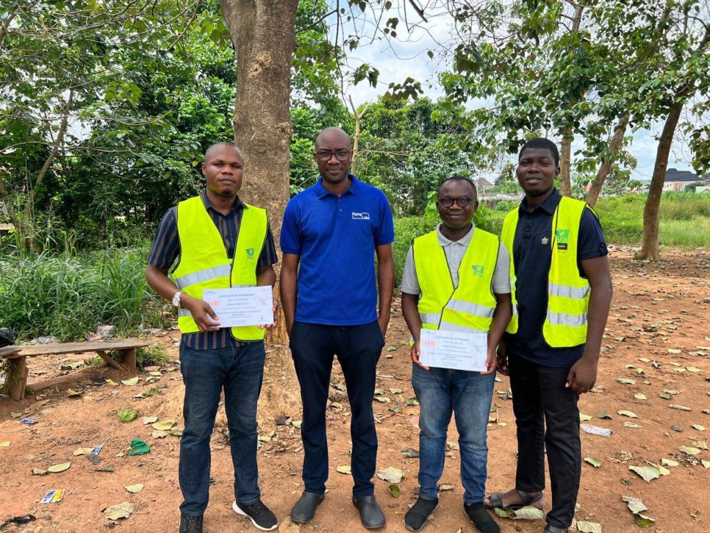
Through this collaborative effort, Ondo State is charting a course toward a sustainable future, where disaster management is not merely a reaction but a proactive, data-driven strategy. By equipping personnel, championing the cause, and leveraging technology and data, the partnership between Nigeria Flying Labs and OSEPA is poised to revolutionize disaster management in the state, ensuring the safety and resilience of its residents for generations to come.
Conclusion
As we look back on our journey, we see the milestones we've achieved together with all our partners: the training, the technology, the partnerships, and the resilience we've built. But our work is far from over. Together, we are poised to face the future with confidence, knowing that we have the tools, the knowledge, and the support of our esteemed partners.
We express our deepest gratitude to WeRobotics, the Flying Labs Network, the Office of the Ondo State Deputy Governor, the Ondo State Environmental Protection Agency, and the Ondo State Emergency Management Agency. Your unwavering support has made all the difference, and we look forward to continuing this transformative journey together.
"Could there be untapped innovative solutions beyond the use of drones and technology in disaster management? What alternative approaches might we explore to further enhance our resilience in the face of natural disasters?"


