Pakistan Flying Labs at Aerothon Drone Tech Expo NUST 2025
Drones, Data and AI for STEM / Youth | January 15, 2026
The teams impressed the audience with demonstrations that truly reflected the spirit of innovation and excellence.
Training on Irrigation Scheme Spatial Database Creation and Management
October 18th, 2023
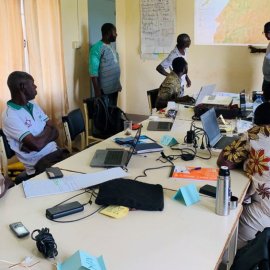
As part of their Turning Data Into Action project, Burkina Faso Flying Labs conducted a 4-day training for agricultural advisors from Projet de Développement Hydro Agricole Soum (PDHS) responsible for monitoring and advising on the development of agricultural plots to create a spatial database.
You will need to give cookie consent in the Experience option to see this video. Click the cookie link at the bottom right of the page to change your preferences.

Discover the use case
Download

