Pakistan Flying Labs at Aerothon Drone Tech Expo NUST 2025
Drones, Data and AI for STEM / Youth | January 15, 2026
The teams impressed the audience with demonstrations that truly reflected the spirit of innovation and excellence.
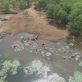
Developing a Transit Corridor Using Drone Based Cartography to Resolve Conflicts Between Farmers and Herders
July 1st, 2022
This project entailed creating a neutral corridor for nomadic herders to keep their animals away from farms to solve increasing conflict between herders and farmers.

Discover the use case
Download

