Reversing Environmental Degradation in Namibia: An Integrated Approach
Namibia Flying Labs leverages drone and data technology to assess land degradation in the Zambezi region, thus guiding environmental restoration efforts.
July 30th, 2024
In Namibia's northern regions, environmental degradation and socio-economic challenges loom large. The densely settled areas face increased poverty and inequality, compounded by the continuous decline in forest cover. This decline leads to loss of biodiversity, reduced soil fertility, and decreased carbon sequestration. This scenario paints a dire picture, but it also sets the stage for a transformative project, aimed at reversing these trends. Together, the Ministry of Environment, Forestry and Tourism (MEFT), the Namibia Integrated Landscape Approach for Enhancing Livelihoods and Environmental Governance to Eradicate Poverty project (NILALEG), the University of Namibia (UNAM), and Flying Labs Namibia (FLN), embarked on a mission to implement integrated management of Namibia’s rural landscapes, promoting sustainable livelihoods and environmental restoration.
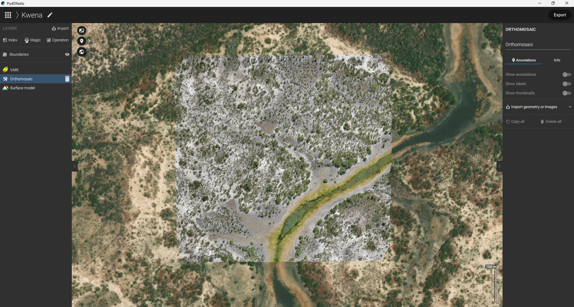
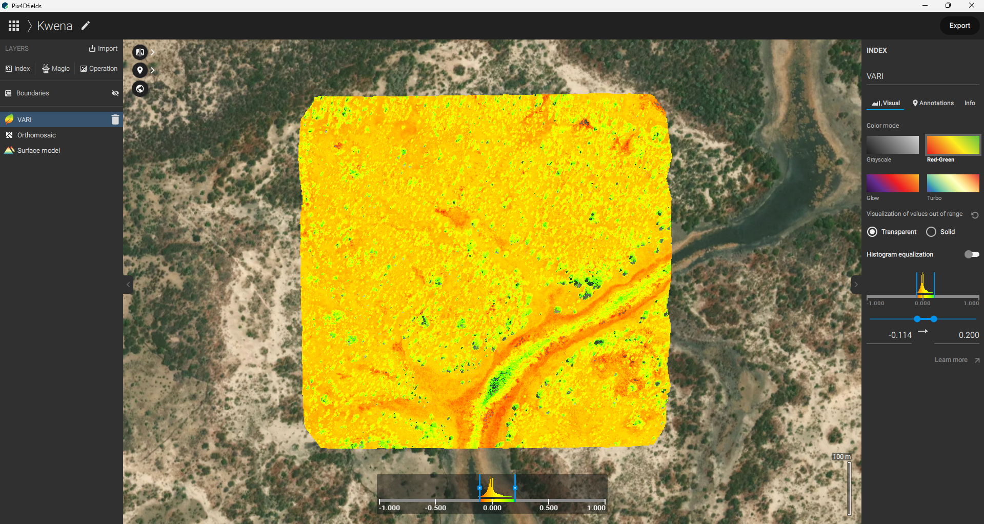
To address these pressing issues, the project focused on comprehensive land degradation assessment in the Zambezi Region. This initiative not only targets environmental restoration but also seeks to promote sustainable livelihoods rooted in nature. By integrating advanced technology and collaborative efforts, we aim to develop a robust action plan for managing Namibia's rural landscapes effectively. The project leverages cutting-edge technology to gather and analyse data, crucial for understanding land degradation. Utilising both fixed-wing and multirotor drones, detailed aerial surveys were conducted. The images captured by these drones were processed using Pix4Dfields, providing high-resolution orthomosaics essential for thorough analyses.
 Pix4DFields orthomosaic
 Pix4DFields VARI
The information derived from these images will be used to assess land degradation through three key sub-indicators: vegetation productivity, land cover, and soil organic carbon. This data is crucial for developing strategies to combat land degradation and promote sustainable land management practices. The data collected will also validate the United Nations Convention to Combat Desertification (UNCCD) land degradation assessment platform, Trends.Earth platform – an open-source tool that provides a holistic view of land change dynamics. This will guide the development of a long-term action plan for managing Namibia's rural landscapes.
The drone-captured data is poised to make a substantial contribution to understanding land degradation within the Zambezi Region; when integrated into Geographic Information Systems (GIS), it shall enhance our ability to analyse and visualise critical information, hence providing a comprehensive view of the landscape. This integration shall facilitate detailed spatial analysis, enabling us to identify patterns, trends, and anomalies, as well as to create high-resolution maps and models that illustrate changes in land cover, soil erosion, vegetation health, and other key indicators pertaining to land degradation. The Zambezi Region has implemented measures to oversee afforestation and land restoration in state forests and parks; therefore, our project shall also assist in evaluating the effectiveness of these measures. This evidence is crucial for determining whether Namibia can report on the status of land degradation using global products, specifically within the landscape in the Zambezi Region.
By addressing these challenges with a comprehensive and integrated approach, we aim to reverse environmental degradation and promote sustainable livelihoods. This project not only holds promise for the Zambezi Region but also serves as a model for similar initiatives across Namibia and beyond.
The project team extends its heartfelt thanks to all our supporting partners and project stakeholders: your collaboration and expertise have been invaluable to this project. Together, we can make a significant impact and pave the way for a brighter, more sustainable future for Namibia's rural communities.
Category(s)
Recent Articles
View All »

Team Cameroon's Road to Victory at the First Global Robotics Competition 2025
