Pakistan Flying Labs at Aerothon Drone Tech Expo NUST 2025
Drones, Data and AI for STEM / Youth | January 15, 2026
The teams impressed the audience with demonstrations that truly reflected the spirit of innovation and excellence.
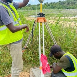
Aerial, LiDAR, and Aeromagnetic Survey for a Renewable Energy Project Site Identification
March 21st, 2024
Ghana Flying Labs shares their experience of performing an aerial survey to identify the optimal terrain for the construction of the nuclear power plant through this use case.

Discover the use case
Download

