By Ghana Flying Labs
Ever heard of UOC? United Oil Company (UOC) is an Ivorian private company headquartered in Abidjan, south of Ivory Coast. UOC has a total area of about 16,300 hectares spread over three agro-industrial sites located in the region of Bas-Sassandra – Bolo and Soubré – Ottawa, covering three (3) plantations: Bolo, Ottawa and Okrouyo. Renowned for producing high-quality agricultural products such palm oil, UOC adheres to international quality standards while meeting customer demands and is committed to sustainable agricultural practices, including eco-friendly cultivation, biodiversity conservation, and responsible resource management.
Recently, UOC signed a contract with Ghana Flying Labs and SKT Live (previously known as SKT Aeroshutter Limited) to provide mapping services for two of their palm plantations. This blog post offers an overview of the mapping work carried out on these plantations, including the project execution, methods, and processes used in the field.
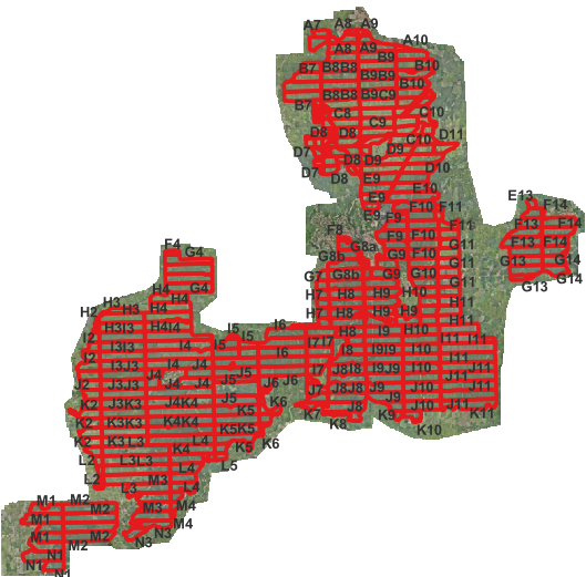
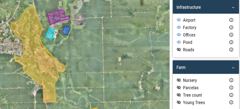
 Map of UOC Bolo Plantation
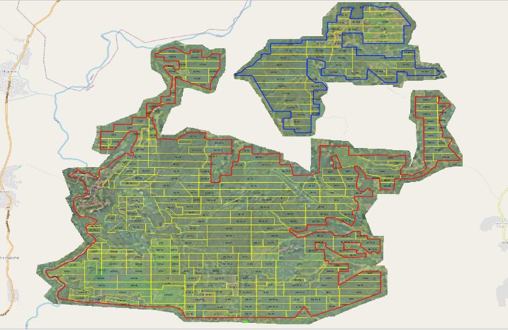
 Map of UOC Ottawa Plantation
Objectives of the Mapping Project
The mapping project aimed to achieve the following:
- Generate RGB (Orthomosaic) Data for the entire plantation.
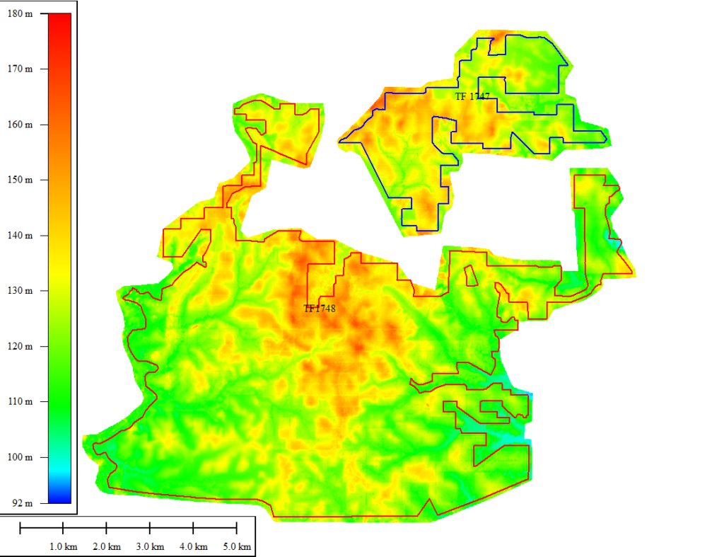
- Provide a Digital Surface Model (DSM) for the entire plantation.
- Collect infrastructure data (Factory, Office, Aerodrome, Waste Pond, and Roads).
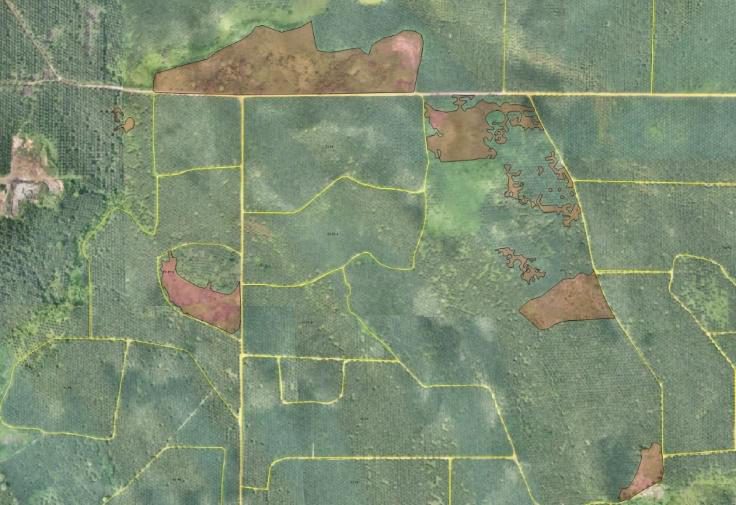
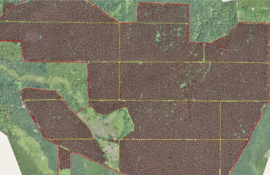
- Digitize the existing plantation parcels.
- Digitize the plantation boundary and correct existing coordinate data.
- Identify empty spaces for planting.
- Provide a tree count.
- Make all these data accessible on our online web platform.
You may be wondering how Ghana Flying Labs achieved these objectives using the Wingtra One drone and GIS technology. The whole process is described below:
 Before starting the survey, the SKT team conducted a thorough reconnaissance both in the office and on-site to assess the plantation’s condition. This initial step helped plan the aerial survey flights, locate suitable areas for establishing ground controls, and identify take-off and landing sites for the plantations.
Following the reconnaissance, the team established control points or utilized existing ones for the aerial survey. The WingtraOne drone, equipped with Post Processing Kinematic (PPK) technology, was used for area mapping. Ground data, including coordinates of base station control pillars and existing plantation boundaries, were collected, verified, and updated. The other control points on-site served as checkpoints, ensuring quality assurance (QA) and quality control (QC) of the survey work. These checkpoints helped assess the accuracy of the aerial survey. Two ground control points were designated as base stations for the flight.
The collected images from the aerial survey were downloaded from the WingtraOne drone, along with GPS data from the base station. These images were then processed using WingtraHub software, incorporating base station data, raw images, and base station locations, all using the WGS 84 coordinate system. The post-processed images were imported into photogrammetric software (Agisoft Metashape) to generate georeferenced Orthomosaic, DSM, and point cloud data.
The successful execution of this project resulted in the production of RGB Orthomosaic maps for the Bolo and Ottawa plantations, tree-count data with the aid of the orthomosaic, machine learning, and GIS technology, identification of empty planting spaces using GIS, and the making of all these data live on our online web platform.

This comprehensive approach ensured accurate mapping and data collection, supporting UOC’s commitment to high-standard, sustainable agricultural practices.


