Mapping Boundaries and Soil Health to Empower Farmers in Nigeria
Aerial insights combined with soil mapping provide a holistic view of farmland, from extent and accessibility to soil fertility and input needs.
September 16th, 2025
At Nigeria Flying Labs, we believe that technology should be accessible to every farmer. Small- and medium-scale farmers in Nigeria are often constrained by inaccurate land records, rising input costs, and limited access to soil data. This leads to guesswork in farm management, affecting both productivity and profitability.
In partnership with AgroXchange, we recently completed a project at a 13-hectare farm in Oko Oba, Mamu, Nigeria, where we applied drones, GIS, and soil science to bring precision agriculture within reach.
Mapping Farm Boundaries with Digital Precision
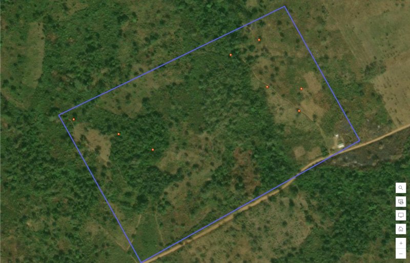
The first step was to establish clear farm boundaries. Using Survey123, our team collected accurate boundary points around the 13-hectare farm. These were digitised and processed into a georeferenced boundary map. For the farmer, this means a verifiable record of the land, which reduces the risk of disputes and provides a reliable foundation for long-term farm planning.


Soil Sampling and Analysis for Better Decisions
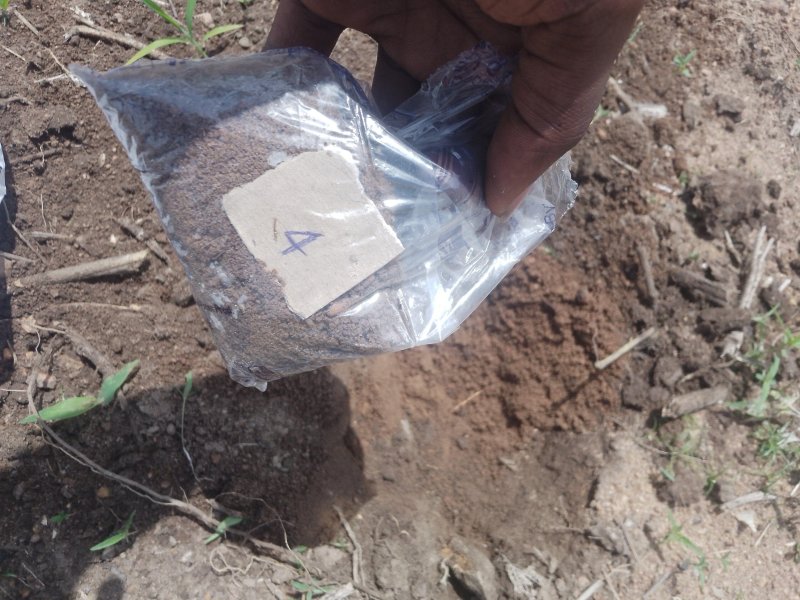
We then turned our attention to the soil—the foundation of productivity. A total of 12 soil samples were collected across the farm in a systematic grid. Each sample was analysed in the laboratory to measure pH, organic matter, and nutrient content, including nitrogen, phosphorus, and potassium. The results provided a clear picture of soil health across the farm.

Turning Data into Action with Maps
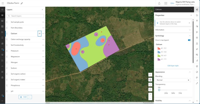
Soil results were spatially interpolated and visualised using ArcGIS, creating an interactive soil map. This digital platform allowed the farmer to view nutrient distribution across the land, making it easy to identify which parts of the farm required more fertiliser and which areas needed less.

By applying fertilisers only where needed, the farmer reduces costs, avoids soil degradation, and increases the chance of better yields.
Impact for Farmers
The benefits were immediate and tangible:
- Accurate farm boundary records improved confidence in land management.
- Targeted soil management helped reduce fertiliser costs and optimise inputs.
- Interactive soil map access gave the farmer a digital tool to guide future planting, investment, and sustainable land use.
Beyond Soil Mapping: Adding Drone-Based Insights
While the soil analysis project gave the farmer deep insights into soil health, we also demonstrated how drones can add further value. For another farm owner, we conducted a drone survey to map the full extent of their land, capturing details of the road network and forest density before and after clearing.
These aerial insights are powerful when combined with soil mapping. Together, they provide a holistic view of the farm—from land extent and accessibility to soil fertility and input needs. This integrated approach enables smarter farm planning, efficient land preparation, and evidence-based investment decisions.

Looking Forward
As we scale these solutions, our goal is to make precision agriculture a reality for more farmers across Nigeria. By combining GIS, drones, and soil science, Nigeria Flying Labs and AgroXchange are supporting data-driven farming that enhances productivity, mitigates risk, and fosters resilience in food systems.
Category(s)
Recent Articles
View All »

Team Cameroon's Road to Victory at the First Global Robotics Competition 2025
