Reaching the Unreached: A Doctor’s Call for Equity
Drones, Data and AI for Health | December 10, 2025
Watch the documentary now to witness Philippines Flying Labs' work using drones to fight tuberculosis in remote communities.
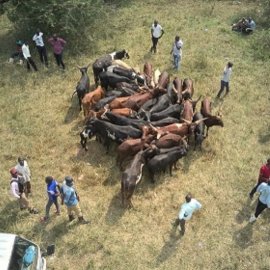
Livestock Management Using Drones and Artificial Intelligence
May 1st, 2021
Through this project, Uganda Flying Labs used drones and Artificial Intelligence to assess the body mass of cattle and reduce illegal animal trafficking with the ultimate goal of improving disease control at checkpoints.

Discover the use case
Download

