
A New Chapter for Nigeria Flying Labs
Impact Story | May 22, 2026
Their work has demonstrated the important role that emerging technologies can play in agriculture, education, and disaster resilience.
Our primary purpose was to assess damage and present the data to the National Research Institute for Earth Science and Disaster Resilience.
November 22nd, 2019
By Taichi Furuhashi, Japan Flying Labs
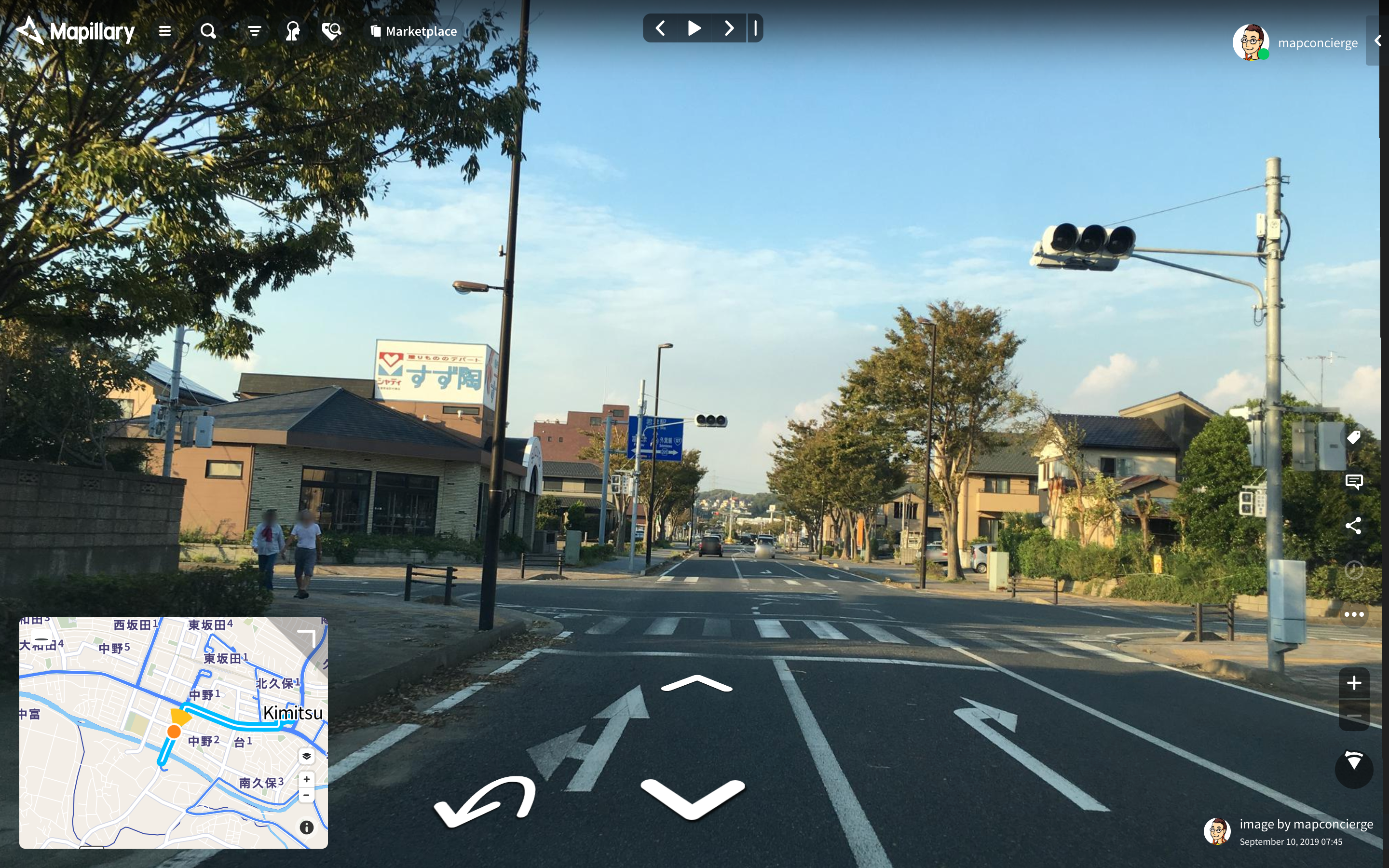
 Typhoon No.15 disaster area Kimitsu city center Aerial image taken on September 10, 2019
On the morning of September 8th, I saw a Tweet from a famous weather forecaster, Mr. Morita. It said: "Typhoon No. 15 (Typhoon Faxai) will go a little more west than forecasted yesterday. It is the worst course for the metropolitan Tokyo area. Typhoon Faxai is expected to hit having a central atmospheric pressure of 960 hectopascals. It is comparable to the Kanogawa Typhoon. This is a dangerous typhoon." As soon as I read it, I imagined that Typhoon Faxai would cause huge damages. Faxai still had a central atmospheric pressure of 960 hectopascals, not subsided at all.
The right semicircle of the typhoon towards the traveling direction is the most dangerous part, and that was on the Izu islands and Boso Peninsula. Typhoon Faxai became more powerful, having a central atmospheric pressure of 955 hectopascals as of 22:00. On September 8th. The next morning, I focused on the Boso Peninsula to collect information to understand the damage. Information obtained from social media such as Twitter showed damage to roofs and buildings by strong winds. I examined the news with my secretary, who has a certificate as a weather forecaster. When assessing the situation comprehensively, I concluded that I should go to the affected area without any delay.
I loaded a fixed-wing drone in my car. I talked to an official at the Crisis Management Section of Kimitsu city, Chiba Prefecture, with which we have a disaster agreement. Then, I headed for the site while contacting DRONE BIRD core members of the disaster rescue team. DRONE BIRD is one of the projects of Crisis Mappers Japan.
We arrived in the central part of Kimitsu city around 11:00 on September 10th.
台風進路、昨日の予想より少し西にずれた。首都圏最悪のコース。上陸時の予想中心気圧は960hPaで、これは狩野川台風に匹敵する。時代が違うから同じように考えられないが、掛け値無しで危険な台風。#台風15号 pic.twitter.com/dBi6hZOVPl
— 森田 正光 (@wm_morita) September 7, 2019
勢力が弱まるどころか、5ヘクトパスカル気圧下がって強まってる! https://t.co/LU3Oze0EnZ
— Taichi (@mapconcierge) September 8, 2019
When I entered the Kisarazu City of Chiba Prefecture side crossing Tokyo Bay via the Aqua Line, there was a power outage, leaving the traffic lights at the intersections inoperable. Whenever I travel, I always use the street view photography app Mapillary to record. But since there were no traffic lights due to a power failure, I had to drive carefully, and it was difficult to travel quickly.
We gathered in front of Kimitsu Station. Based on the disaster agreement with Kimitsu City and Article 132-3 of the Aviation Law (Act No. 231 of 1952) (special case for search, rescue, etc.), we set up our base in Fureai Park and started our plan to fly a fixed-wing drone eBee Classic. We flew the drone four times to get aerial imagery.
Our primary purpose was to assess the damage of roofs and houses, and we set the altitude to 140m above ground for a resolution of about 5 cm.
The number of photographs taken was about 1,100, and a repository was made available in GitHub to save related information such as original image data and the flight log of KML. I visited the Crisis Management Section of Kimitsu City Hall in the evening on the same day, and I handed the SD card containing the imagery dataset in KML format as they can view it on Google Earth even without an internet connection. While we were there, the mayor of Kimitsu, who was busy dealing with disaster response, came in and checked our imagery data.
On the next day, we uploaded 1,100 ortho-mosaic images to OpenAerialMap and XYZ tiles for various geographic information systems (GIS), were published as open data.
We added it as a layer to Hinata GIS of Miyazaki Prefecture. You can browse it with one click through the Permalink. At first glance, the damage in the central part of Kimitsu city is hard to see, but we can recognize its extent on roofs, TV antennae, and collapsed houses due to aerial imagery.
The same data was provided to the National Research Institute for Earth Science and Disaster Resilience (NIED) to make it available to more people, as well as on the Shared Information Platform for Disaster Management (SiP4D).
The main reason why we could operate a drone so quickly to take aerial imagery is that we signed the disaster agreement with Kimitsu city in April 2019 before Typhoon Faxai hitting.
Kimitsu City started issuing a disaster victim certificate to citizens from September 21st, more than ten days after Typhoon Faxai hit. The aerial imagery, together with site survey and photos taken immediately after the disaster, will be used as information to judge the damage situation objectively.
Before Typhoon No. 15 (Typhoon Faxai) hit, there was heavy rain in northern Kyushu. We operated a fixed-wing type drone in the Saga Prefecture as well (we are planning to write about it soon). To ascertain the damage situation as quickly as possible, how should we share the method to take aerial imagery and the obtained aerial imagery? How can information be provided under the condition of blackout and no communication line while infrastructure restoration work is still underway on this occasion? There are still many issues to be solved.
Above all, it is difficult to operate a drone actively in areas where disaster agreements have not been concluded. We have to expand the circle of drone disaster agreements steadily.
There are still many things to do to strengthen local disaster prevention and disaster response capabilities. I should keep tackling them, taking advantage of the experience this time.

