Drones & AI Help Improve Conservation, Sustainability Efforts In a Protected Area
The project was part of a partnership exploring the use of drones and AI to remove constraints on migratory bird inventories and wetland mapping.
June 10th, 2020
By Tiamiyou Radji, Senegal Flying Labs
The use of drones and artificial intelligence (AI) to support decision making in ecological protection and management is a reality. The Senegal Flying Labs team with GIS experts from the DPN and DAMP have spent time training using Picterra Detector to count and characterize birds accurately.
 Mangrove mapping
On March 8, 2020, Senegal Flying Labs completed a training course on drone piloting for the Ministry of Environment to better manage protected areas. The objective was to improve the monitoring and data collection system on biodiversity through the use of innovative technologies and consisted of teaching drone piloting, data collection methods, and how to analyze the collected data. This project is part of a partnership exploring the use of drones and AI for sustainable management of protected areas to remove constraints on migratory bird inventories and wetland mapping.
The Palmarin Community Nature Reserve (RNCP) hosted the first training session. Created in May 2001, the Palmarin Community Nature Reserve spans 10,340 hectares. It's bounded to the north by the communes of Joal-Fadiouth and Fimela to its north and east, to the south by the Saloum Inlet and the Dionewar commune, and the Atlantic Ocean to the west. The Joal-Djiffère road divides the reserve in two: a continental portion that follows the contours of the commune, and a maritime fringe along the Atlantic coast that extends from Palmarin Faco to Joal. The vegetation is Sudano-Guinean type, bordered by a hearty ecosystem of mangrove forests in the estuaries. Wildlife includes gulls, marsh harriers, kestrels, and pink flamingos. Certain species of birds live here all year round, but the reserve is also an attractive destination for colonies of migratory birds from twelve European countries.
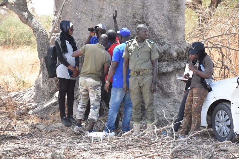
The training lasted for four days and included 27 participants composed of conservationists, decision-makers from the Ministry of the Environment, and participants from communities living on reserves. The training consisted of a theoretical part and practical cases of piloting for the data collection followed by data processing, including the use of Picterra and Pix4D.
Muhammad Sangaré, an ecosystem manager of the Palmarin Protected Area since 2019, focuses primarily on the conservation of biodiversity, which covers the biological, physiological, and cultural aspects of the protected area. He appreciated taking part in this training, which was timely, as he noted because they "are used to seeing drones in projects related to agriculture. It's the first time to see that we can use drones for nature conservation. What the drones also gave us was time-saving." He added, "our inventories took time, but the drone saved us time and allowed us to fly over inaccessible areas."
For the first time, drones were able to operate in areas inaccessible by foot, land craft, or boats. And data collected with binoculars and telescopes only allowed them to make estimates. Even the triangulation by bird count campaigns from spot maps acquired by satellites (the more common method) was equally unreliable. The accuracy of data collected by drones may have spurred further enthusiasm toward adopting widespread use of drone-monitoring of protected areas.
According to Captain Niasse, Director of the DAMCP, the use of drones is responsible for improving the decision support tools developed by the Monitoring and Evaluation Unit of the Directorate of Community Marine Protected Areas (DAMCP). Captain Aissatou Niasse said that she is looking forward to a lasting partnership. "The objective was to make the Baba with the maximum number of actors, but at the end of this training, a team will have to be selected to train them in a more precise manner on collection and analysis techniques," said Captain Niasse. From now on, the collection and processing of data will be done with significant economies of scale because software, such as Picterra, will enable the interpretation and production of deliverables quickly.
Robotics and artificial intelligence are now technologies to be taken into account in the monitoring-evaluation of protected areas. Developing the human capital of the agents involved in the integrated management of protected areas is an integral part of the strategy for biodiversity conservation.
Category(s)
Recent Articles
View All »

Team Cameroon's Road to Victory at the First Global Robotics Competition 2025
