Reaching the Unreached: A Doctor’s Call for Equity
Drones, Data and AI for Health | December 10, 2025
Watch the documentary now to witness Philippines Flying Labs' work using drones to fight tuberculosis in remote communities.
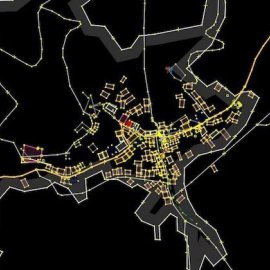
Youth mapped their community using tools such as OpenStreetMap (OSM)
January 15th, 2020
Nepal Flying Labs engaged students in a 3-day training to create drone awareness and map their community using open source mapping tools like OpenStreetMap (OSM).

Discover the use case
Download


