A New Ally in Aerial Seeding and Mangrove Restoration
ReleaseLabs, offering autonomous release systems for drone-based deliveries, teamed up with Panama Flying Labs to use adapted drones to restore two ecosystems.
June 9th, 2021
By ReleaseLabs and Panama Flying Labs
 Sustainable forest management needs to be closely integrated with local communities. They are far better placed than anyone else to maintain and increase the services, economic benefits, and health of forests for their development and quality of life. Therefore, strong and adequately established community-based organizations are essential to successfully implementing sustainable forest management, says the Food and Agriculture Organization (FAO) of the United Nations.
 Just like local communities are essential to long-term sustainable reforestation, local partners like Flying Labs are vital to providing technical support using drones. Why drones? Hand planting can be tedious and time-consuming, particularly in areas that are difficult to get to. So drones may add value to seeding and reforestation in some instances. This is why ReleaseLabs, which offers autonomous release systems for drone-based deliveries, teamed up with Panama Flying Labs in April.
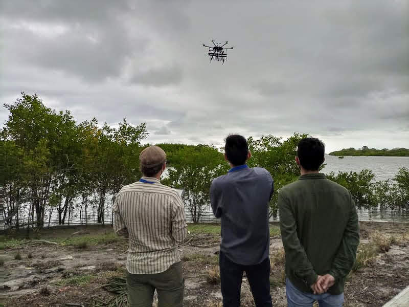
We co-led a technical demonstration in Panama using specially adapted drones to restore the ecosystems in two communities in the Central Provinces. The live demonstration was carried out by Panama Flying Labs, WeRobotics, Release Labs, and Beta Earth. Panama Flying Labs was in charge of flying the drones, logistics, permits, and bringing together key stakeholders—above all, community members. WeRobotics coordinated the overall project, while Release Labs was responsible for the technical development of the release systems.
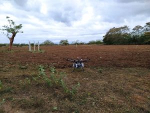
The Provinces of Panama Oeste and Coclé witnessed the first test using drone technology to restore land plots. The drone-optimized release system, which Release Labs developed, can carry 750+ seed balls per load and distribute those accurately in less than five minutes over one hectare. With this method, the drone dramatically speeds up the planting efforts and outperforms traditional hand planting, especially in hard-to-access terrain.
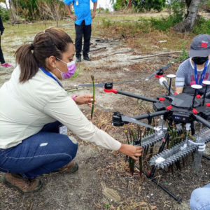
Our first tests proved that the drone and the release system could load, store, and release the fresh mangrove propagules as designed. What’s more, the fully autonomous system achieved a good percentage of the dropped propagules penetrate and enter the soil when released from about 2-3 meters altitude. This is promising when looking for alternatives to hand-planting mangroves.
 But, once again, it’s not about the drone. It’s about community engagement. Drone seeding is the easy part. Far more challenging is ensuring that those seeds can grow. This takes active engagement by local communities. In our particular case, Pastoral Social-Cáritas offered their eight hectares to develop the demonstration, including the valuable presence of the Los Pollos community’s members as witnesses of the trial. In addition, another land plot was restored at Penonomé community, on the grounds of the Penonomé penitentiary centre. The follow-up of this particular plot will be in the hands of the inmates. Through the social integration program, they will support comparing the effectiveness of drone planting vs. hand planting. This is why it is not about technology. It is about social integration, community engagement, and the power of local.
Last but not least, the teams also tested a new release system for mangrove propagules. Mangroves store five times more carbon in their soils by surface area than tropical forests and ten times more than temperate forests. They also provide shelter for marine life and absorb microplastics. However, hand planting mangroves can be cumbersome in muddy terrain and hard-to-reach areas. Thus, the use of drones may potentially scale up and accelerate mangrove restoration.
Please get in touch if you want to explore further or if you have different use-case needs in mind.
Category(s)
Location(s)
Recent Articles
View All »

Team Cameroon's Road to Victory at the First Global Robotics Competition 2025
