 Most delivery drones operate well beyond the visual line of sight (BVLOS). Satellites can provide imagery and terrain information of delivery points. But this data is not always reliable. This is due to the spatial and temporal resolutions of satellite imagery. That is to say, if a new cell tower is built, satellite images may not be up-to-date. To ensure the best and safest delivery flight plans, the ground control team that oversees the cargo drone flights must have a 3D immersive sense of where to deliver the packages and avoid obstacles. This is especially true for fixed-wing cargo drones as these operate differently from obstacle-avoiding multi-rotors.
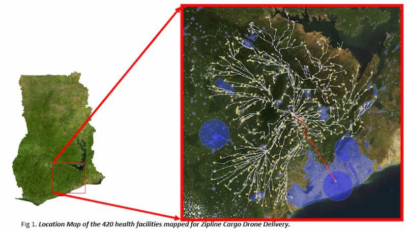

Using Drones for Post-incident Damage Assessment at Assigamé Market
Drones, Data and AI for Disaster | June 18, 2026
When fire and an acid leak struck Lomé's Assigamé market, Togo Flying Labs mapped the danger zone by drone in hours—helping authorities protect residents fast.

