Using Drones for Olive Ridley Turtle Conservation in Goa, India
The project aimed to use drones to conduct population assessments of Olive ridley turtles in India.
May 17th, 2021
By Shashank Srinivasan and Nandini Mehrotra | Technology for Wildlife
Olive ridley sea turtles are classified as ‘Vulnerable’ on the IUCN Red List; the primary reason is the decline of the adult population. Some estimates indicate that the number of baby hatchlings that survive to adulthood can be as low as one in a thousand. However, less optimistic estimates suggest that the survival rate could be as low as one in ten thousand. Females return to the same beach on which they are born to lay their eggs, and thus nesting sites around the world remain largely static. However, human activities can disturb or even harm turtles, reducing the amount of beach real estate available to them for nesting purposes.
In recent years, researchers have been developing methods that use drones to document nesting turtles and conduct assessments of their population. Studies conducted by Duke University and the University of Exeter have demonstrated that these methods can be robust and cost-effective. This is important in the conservation sector, where resources and time saved can be redirected to other conservation efforts. As of April 2021, drones have not been used in India to conduct population assessments of Olive ridley turtles; we wanted to test and demonstrate the feasibility with this project. We thus initiated a collaboration across three sectors—the Goa Forest Department representing the government, WWF-India in their capacity as an established conservation NGO and Technology for Wildlife representing the private sector.
Before implementing the project, weeks of discussion, coordination, and efforts were made between all three parties to ensure smooth collaboration and that the project would meet all legal and regulatory requirements under Indian law. Once this was all in place, the fieldwork was executed in the first week of March 2021.
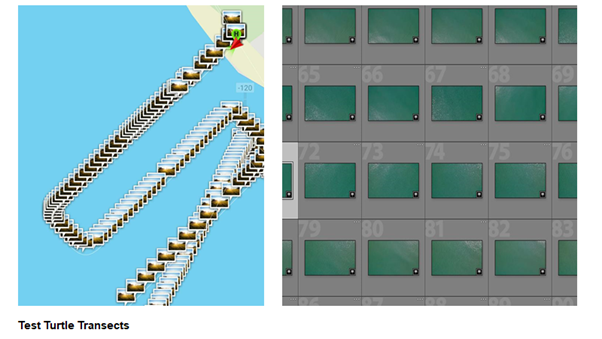
The objective of this project was to acquire aerial imagery and video footage over Morjim beach, which was further processed to create a high-resolution orthomosaic, a 3D model of the beach, and a 360° aerial panorama. We conducted test transects parallel and perpendicular to the beach. The imagery was captured at an r.5 cm/pixel resolution, which previous studies had established as an optimal resolution to detect adult turtles. We also attached a polarising filter to the drone camera to reduce solar reflection off the sea.

We then flew the drone in a grid pattern over the beach, intending to use these images to create a high-resolution ortho-mosaic map and a 3D model of the beach topography. Finally, we captured aerial imagery and videos for communication and advocacy purposes.
Fieldwork took place on Morjim Beach, near the turtle interpretation Centre of the Goa Forest Department, on a day that turtle hatchlings were to be released. We met with Rajan Halankar, who has worked for 22 years with the Forest Department on turtle conservation in Goa. We were able to document him and the rest of his team examining the nests for signs of hatching. After sunset, they released the hatchlings into the ocean while managing interested tourists and visitors.
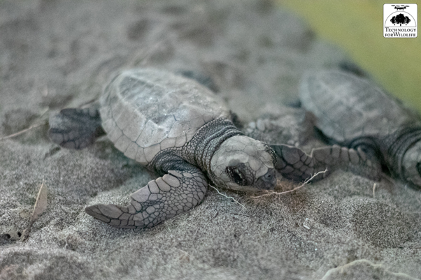
 Baby Olive Ridley Turtle
Through this project, we were able to collect media and data which can be used to enhance research for Olive ridley conservation in Goa. The successfully conducted test transects are a starting point for future population surveys using drones. These results and the media and data collected can also be used for policy, advocacy, conservation planning, and community engagement. Finally, as a successful conservation collaboration between three organisations from the government, nonprofit, and private enterprise sectors in India, using cutting-edge technology will only inform and benefit future such initiatives.
Category(s)
Location(s)
Recent Articles
View All »

Wildfire Assessment and Web Application in Sao Paulo
