
Using Aerial Robotics for Cadastral Surveys in Nepal
Nepal Flying Labs conducts a pilot study to compare the effectiveness of drones in cadastral surveying to the other existing methods.
May 19th, 2017
Background
 An example of an older cadastral map.
Cadastral mapping of Nepal began in 1964 after implementation of the Land (Survey) Act 2019. It produced new cadastral maps and records, district by district, until completion in 1998. All of these cadastral maps were prepared through the traditional plane table survey. However, as more people began to migrate, problems arose due to parcel segmentation. This is when a landowner sells a portion of their land to someone else, resulting in multiple segments of the same parcel now being owned by different people. This results in older maps becoming inaccurate and creating the need for regular updates. Many homeowners have begun to complain that areas on the map do not fit with their landowner certificates, and that there are variations in map distances and ground distances.
With advancements in surveying and mapping technology, the survey offices started to make use of Total Station, an electronic device for collecting geodata. This new technique for capturing spatial data proved to be very efficient compared to the existing plane table surveying, however the rate of work could still be improved on. There had also been research into the use of GPS technology, as well as high resolution satellite images, for capturing datasets for the cadastral surveys. But these methods haven’t been brought into practice officially on a larger scale yet.
The advent of low cost aerial robotics (UAVs / Drones), has opened up the realm of possibilities in this field tremendously allowing people to easily and quickly map just about any location. The technology is very user friendly - people can quickly deploy to capture high resolution aerial images, producing understandable representations of the parcels, and easily update the existing maps. The use of aerial robotics for cadastral mapping in Nepal is also highly relevant, as large portions of the country contain complex terrain (from very high Himalayas to the plain of Terai). While previously professionals had to trek out into hazardous conditions with all their gear to be able to create these maps, aerial robotic can now be flown in from a safe location with minimal risk to the users.
Project
Nepal Flying Labs was requested by the Survey Office of Ramechhap District in Nepal to do a pilot study to compare the effectiveness of UAVs/drones in cadastral surveying to the other existing methods: Total Station, GPS, and satellites. We were asked to perform an aerial survey at Manthali Municipality, Ward no 2 - Karambot, an area which has seen multiple landowner disputes in recent times.
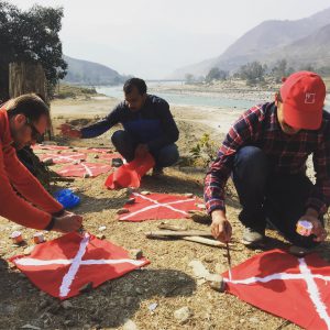
The DJI Inspire drone we used captured high resolution orthophoto images which were then processed to create a cadastral map of the area, allowing surveyors to digitize the parcel boundaries of the region. The remainder of the project focused on a comparative study of parcel boundary delineation between high resolution UAV imagery and existing paper based maps. The criteria that were being assessed were spatial accuracy and affordability. Ground control points were also set up throughout the project area to be later used in enhancing the accuracy of the project outputs, and relating them to existing government datasets. You can see the resulting GIS and orthophoto maps below:
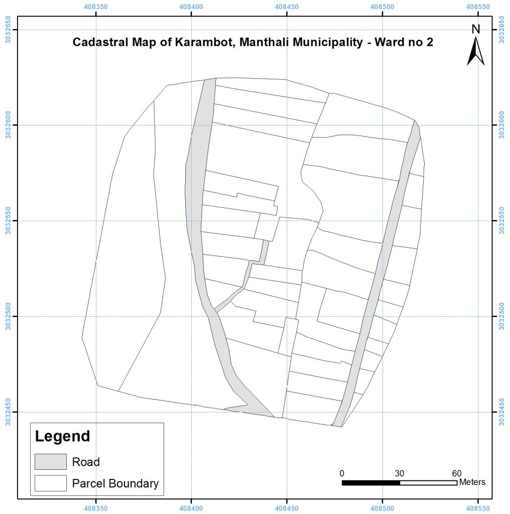 This is the newly created cadastral map of the same area using the aerial imagery we captured.
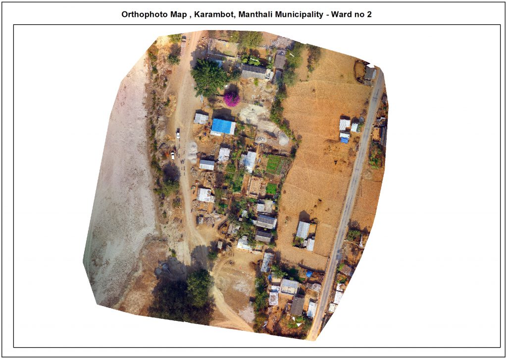 And this is the orthophoto map of the area, using the actual imagery.
The project proved that at a minimum, existing cadastral systems used in Nepal can be supported and enhanced through aerial robotics. They have been proved to efficiently create highly accurate outputs in a much smaller time frame than other solutions.
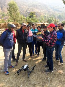
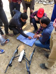
Below you can find a few photographs of the team as they carried out this project. In the first image we explained to the community the goals of our mission, and in the second photo you can see the residents of the town providing us with their feedback on the boundary issues. In the last photo we hand-painted the ground control points to be able to relate our imagery to existing government data.
Category(s)
Location(s)
Recent Articles
View All »

Wildfire Assessment and Web Application in Sao Paulo
