
Revolutionizing Mining Waste Management: A Drone's Eye View of Attapulgite Tailings in Thiès
Senegal Flying Labs leverages drone technology to estimate mining waste reserves and explore its potential uses, thus reducing its accumulation.
April 29th, 2024
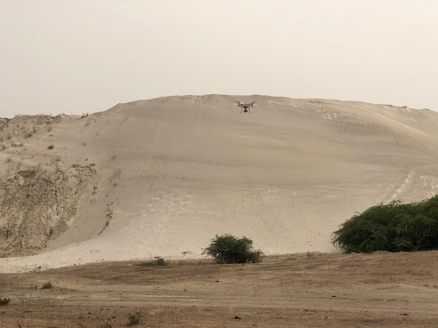
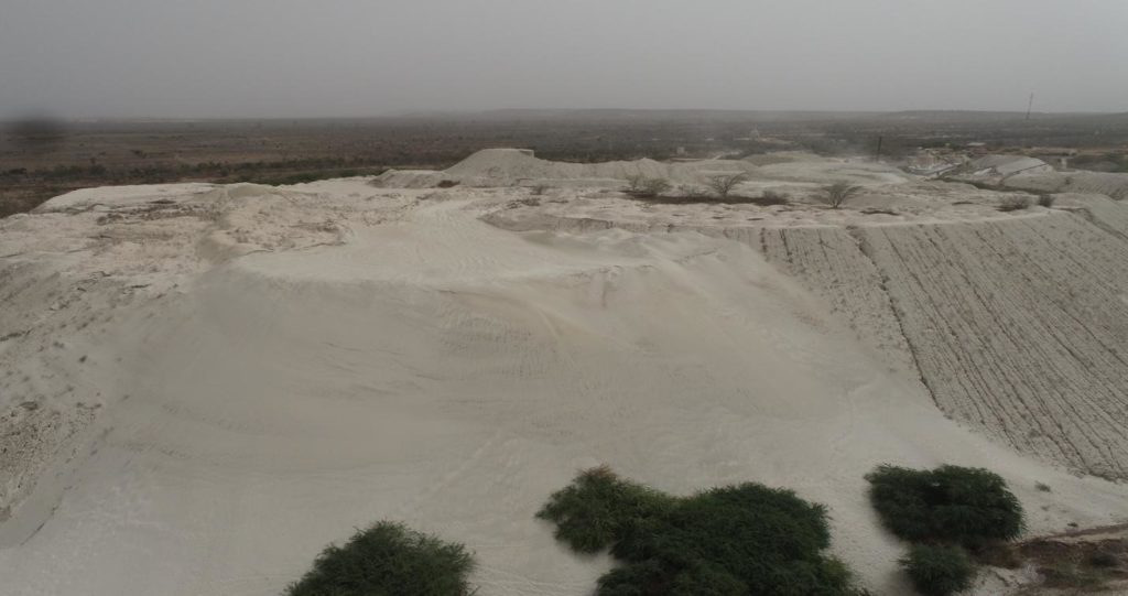
In the heart of Senegal's Thiès region lies the Allou Kagne area, a landscape marred by the haunting presence of mining waste, predominantly composed of attapulgite. A clay-based mineral, attapulgite is an important industrial additive used in the manufacturing, automotive, pharmaceutical, and agricultural industries, among others. After a mineral has been extracted from the ore, the materials left behind – such as crushed rock, water, and traces of metals – are known as tailings. These remnants are often discarded after mining and do not only signify the footprint of industrial activity but also pose significant environmental threat, detrimentally impacting both local communities and the delicate balance of the region's ecosystems, particularly within the classified forests, which are protected areas.
In response to this pressing challenge, Ecole Nationale Supérieure des Mines et de la Géologie (ENSMG), formerly known as the Institut des Sciences de la Terre (IST), spearheaded a collaborative research initiative to find ways of reducing the continued accumulation of the tailings by looking into their potential uses. With Senegal Flying Labs as a technical partner and the support of the Société Sénégalaise des Phosphates de Thiès (SSPT), the project aimed to leverage drone technology to discover an estimation of the waste reserves and explore its integration into the formulation of concrete and the production of brick or paver, thus revolutionizing mining waste management.
Traditionally, the mapping and estimation of attapulgite tailings relied heavily on labor-intensive and time-consuming survey methods. These approaches, often conducted in hazardous environments, posed inherent risks and limitations to those employing them. Drones have proved to offer a great improvement to mining site surveillance and analysis, offering multifaceted benefits. Analyzing earthworks and estimating storage volumes precisely, drones provided a comprehensive 3D model of the terrain, replete with accurate data and vivid visual support through photos and videos that enhanced accessibility in certain areas. Beyond mapping, they also facilitated daily monitoring, enabling real-time identification of surface cracks, equipment malfunctions, and environmental compliance issues.
The outcomes of the project were profound. By successfully estimating the reserves and exploring innovative applications of attapulgite rejects in concrete and construction materials, our team revealed the untapped potential within mining waste. These findings do not just contribute to the optimization of resource utilization but also underscore the importance of sustainable practices in mitigating environmental degradation.
Central to the success of this endeavor was the collaboration between academia, industry, and technology partners. For data processing and analysis, the project owes much to innovative software partners such as Pix4D, ESRI, and DJI. Their solutions, coupled with the expertise of the research team, facilitated the translation of drone-generated data into actionable insights, further enriching the project's impact and applicability. Notably, the main beneficiaries were students from the Master Gestion et Evaluation des Rejets Miniers (IST-ISE) program, who gained firsthand experience in applying cutting-edge solutions to real-world challenges and valuable insights for their end-of-study dissertations. Additionally, the project aided ENSMG in developing new mapping techniques and SSPT in assessing mining waste, thus ensuring the seamless integration of drone technology into the mining waste management framework.
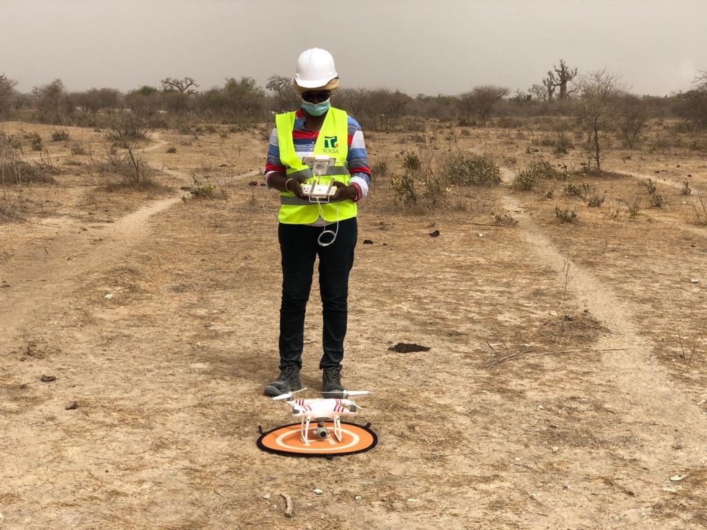 Adama DIOP, Master's in Environment and Mine Waste Management
Looking ahead, this research project is only part of the journey. Drone technology, now established as a valuable addition to mining site monitoring, holds promise for greater environmental conservation in this field. We anticipate that future endeavors will focus on capitalizing on this technology to enhance spatial organization, optimize storage, and further refine reserve estimates, thus paving the way for a more sustainable future in mining waste management.
Aligning with Sustainable Development Goal 15, which focuses on promoting the sustainable use of terrestrial ecosystems to protect and restore life on land, this project showcases the value of drone technology in optimizing resource management in the mining industry. Furthermore it is proof that interdisciplinary collaboration is a key component of addressing pressing environmental challenges. This was Senegal Flying Labs’ takeaway, along with the hope of a greener, more resilient future for the Thiès region.
Category(s)
Recent Articles
View All »

Team Cameroon's Road to Victory at the First Global Robotics Competition 2025
