Reaching the Unreached: A Doctor’s Call for Equity
Drones, Data and AI for Health | December 10, 2025
Watch the documentary now to witness Philippines Flying Labs' work using drones to fight tuberculosis in remote communities.
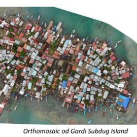
Re-locating the Gardi Subdug Community in Panama Due to Sea Level Rise with the Help of Drone Data
February 1st, 2020
This use case features a drone mapping project by Panama Flying Labs that aimed to contribute to the development of a relocation plan for the community of Gardi Sugdub - an island sinking due to climate change and rising sea levels.

Discover the use case
Download


