Pakistan Flying Labs at Aerothon Drone Tech Expo NUST 2025
Drones, Data and AI for STEM / Youth | January 15, 2026
The teams impressed the audience with demonstrations that truly reflected the spirit of innovation and excellence.
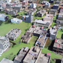
Flood Emergency Mapping Using Drone Data in Keur Massar, Senegal
February 1st, 2020
This use case features a drone mapping project by Senegal Flying Labs in 2019 to map the flooded areas of Keur Massar with centimeter-level precision to assess the extent of damages and produce data for the International Committee of the Red Cross

Discover the use case
Download

