Reaching the Unreached: A Doctor’s Call for Equity
Drones, Data and AI for Health | December 10, 2025
Watch the documentary now to witness Philippines Flying Labs' work using drones to fight tuberculosis in remote communities.
A Case Study at Turkwel Dam and Its Basins
September 1st, 2021
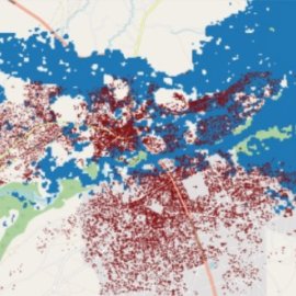
In this use case, Kenya Flying Labs discusses their use of satellite data to study Turkwel dam to create a flood map and a flood model template of the basins, showing the extent of water increase in the reservoir and the volume of the flood.

Discover the use case
Download


