Pakistan Flying Labs at Aerothon Drone Tech Expo NUST 2025
Drones, Data and AI for STEM / Youth | January 15, 2026
The teams impressed the audience with demonstrations that truly reflected the spirit of innovation and excellence.
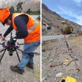
Enhancing River Defense Design with UAV LiDAR Data in Peruvian Valley
January 20th, 2024
This use case shares how Peru Flying Labs collected elevation data from LiDAR sensors to provide reliable topographic information that would be used in the design of river defense.

Discover the use case
Download


