Pakistan Flying Labs at Aerothon Drone Tech Expo NUST 2025
Drones, Data and AI for STEM / Youth | January 15, 2026
The teams impressed the audience with demonstrations that truly reflected the spirit of innovation and excellence.
The project aimed to demonstrate the potential of drone technology in detecting defects in solar panels and promoting sustainable maintenance practices.
January 15th, 2025
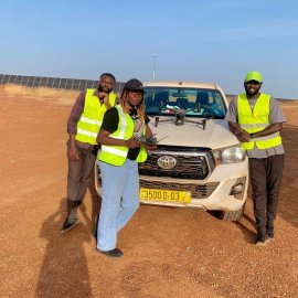
Burkina Faso and Namibia Flying Labs teamed up in the inspection of a 20MW photovoltaic power plant in Tenkodogo, Burkina Faso. The team successfully mapped 50 hectares of solar power plant using a DJI Matrice 30T drone and the data used by the client to influence maintenance plans. The project also aims to help increase community access to clean energy. The resulting inspection report provided actionable insights for prioritizing maintenance activities, helping to prevent economic losses and improve energy efficiency

Discover the use case
Download


