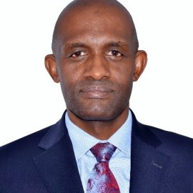
Dr. Aggrey Agumya
Technical Director

Dr. Agumya is a Director of Ratidzo SpatialTech Limited. He is a land and engineering surveyor as well as a Geographic Information Systems (GIS) professional. He holds a BSc in Surveying and Photogrammetry, plus MSc (ITC, The Netherlands) and Ph.D. degrees in Geomatics specializing in GIS and Remote Sensing (University of Melbourne, Australia). He is a Registered Surveyor of Uganda (RSU) with more than 25 years’ experience in the surveying domain, initially serving as a lecturer of the first cohort of Ugandan-trained land surveying graduates, and thereafter as a professional cadastral and engineering surveyor in the private sector. He is also a Member of the Institution of Surveyors of Uganda. Dr. Agumya has 20 years’ experience of professional practice in GIS and Remote Sensing. This has mainly been in the domain of research, and in particular in agriculture and natural resource management applications. His work in GIS at the World Agroforestry Centre and at the Forum for Agricultural Research in Africa spans the entire African continent. Over the past five years, Dr. Agumya’s interest has been focused on the deployment of spatial tools in development work on the continent, notably towards improving food security, incomes, and resilience to climate change-induced shocks.