Underwater Drones: Lessons From East Africa
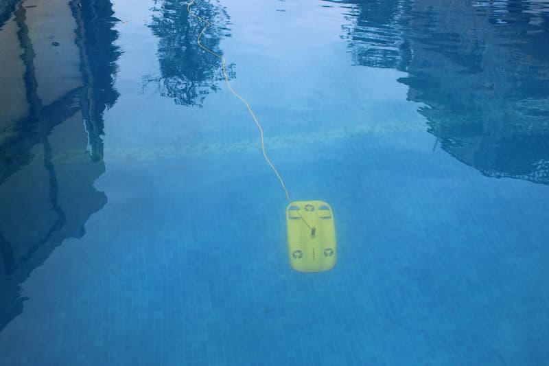
Tanzania Flying Labs' initial field experience of the Gladius Mini from Chasing Innovation, a highly recommended underwater (UW) drone.
September 1st, 2021
This isn’t necessarily a product review but rather the sharing of an initial field experience of a highly recommended underwater (UW) drone called the Gladius Mini from Chasing Innovation.
 The Gladius Mini from Chasing Innovation
Our Fijian colleagues were the pioneering team within the Flying Labs network to trial UW drones a couple of years ago. Globally, Flying Labs support the United Nations Sustainable Development Goals by using robotics technology at the local level.
Aerial robots like drones have given humanity the capability to acquire timely and actionable data. But oceans cover 70 percent of the Earth’s surface, and very little of them have been explored. UW drones in the same price range as your typical DJI quadcopter have significantly improved in the last couple of years. Yes, there is still no GPS, but with a bit of creativity, we can now gain insights from marine environments to protect critical underwater habitats (SDG #14).
The following observations are mainly a reaction to the previously mentioned blog post from Fiji and a few additional recommendations by us:
Mapping
Lately, we have noticed some new names for aquatic mapping drones like underwater surface vehicles (USVs). Perhaps we should still call the current class of UW drones remotely operated vehicles (ROVs) because they cannot operate or, more specifically, navigate autonomously yet. However, the Gladius Mini has the most impressive stabilization and features like tilt-lock that we have seen to date. It has intelligent auxiliary motors that automatically correct for invisible currents, similar to how aerial drones correct for wind. In addition, it can lock on to a compass bearing, making transects possible. Note the on-screen display.
We intend to use the tether as a ruler by marking notches on it as such. Once you know your GPS position on a boat or land, depth, and bearing, you should tag underwater features on a contour map and monitor them over time.
Tether Whatever
There is no need to worry anymore about short tethers because the Gladius comes with a 100 m tether allowing you to explore more than a 70 m radius if you dive down to 20 m. However, we recommend you ditch the drum it comes with and carefully place the tether in a bucket. The bucket gives you the added advantage of bathing the ROV with tap water afterward. Just dip it in and rinse. You’ll thank us later.
4K Camera
Being drone mappers, we have always wished a manufacturer would place a camera below an ROV since most models, including the Gladius, come with a front-facing camera. But not a problem because it can tilt down to 45° and lock that position and move in any direction very smoothly at low speed. The same can be achieved by tilting up if you want to inspect ship hulls or the like. Colors are lost underwater at depth, with red being the first to be wholly absorbed in ~5 m. During deep dives, keep this in mind because you will have to “color correct” your footage afterward.
Tips
- You still need to throw a towel over your head to prevent sun glare :-)
- Use silicon grease typically used for diving regulators on the O-rings
- Wrap the base in a Ziplock bag to prevent it from getting wet
- Perform compass calibration before deployment and check it once in a while to make sure you’re pointing in the right direction
- Locking the motors after you complete a dive allows the ROV to surface on its own, thereby conserving the battery
- Avoid deployment from the land if possible. It’s much easier and convenient to be on a boat floating over the area of interest. You will avoid extra sand and seaweed ingress, plus you save time and, therefore, battery
- It’s easier and advisable to ascend over mounds than descend
Upgrade
A new version of the Gladius Mini just came out. Essentially, the base and the controller have been merged, and you no longer need to use Bluetooth to control the drone. We have noticed that it’s also possible to use Android, whereas we could only use iOS to connect before. You still cannot view the battery level while charging, but it’s not a big deal.
Overall we’re delighted with the preliminary results. This UW drone’s arrival is timely since we have always wanted to leap beyond aerial drones, which have dominated most of our work since inception.
Category(s)
Recent Articles
View All »

Team Cameroon's Road to Victory at the First Global Robotics Competition 2025
