Senegal Flying Labs Lance L’utilisation Des Drones Dans Le Comptage Des Oiseaux D’eau Au Sénégal Pour La Conservation De La Biodiversité
Le projet a démontré les possibilités d'utilisation des drones pour la conservation, la préservation de la biodiversité et la gestion du patrimoine naturel.
May 3rd, 2021

Senegal Flying Labs (SFL), la Direction des Parcs Nationaux et la Direction des Aires Marines Communautaires Protégées ont signé ensemble un partenariat qui entre dans le cadre de la formation et de la recherche sur l’utilisation de nouvelles technologies pour la gestion durable des ressources naturelles et la conservation de la biodiversité. Ce partenariat va permettre:
- L’élaboration et la mise en œuvre de programmes de formation et de recherche;
- L’élaboration et la mise en œuvre de stratégies de surveillance active et bioécologiques;
- La facilitation de l’accès à la connaissance scientifique (échange de documentation, publications, colloques,…);
- L’appui technique et administratif en fonction des besoins spécifiques identifiés;
- La promotion et participation à toutes formes d’échanges susceptibles d’intéresser leurs structures et leurs personnels.
Une formation des agents du ministère a déjà eu lieu en janvier 2020 à Palmarin afin de les initier à l’utilisation de la technologie des drones et des logiciels de télédétection. Afin d’asseoir les bases de la collaboration, le directeur de Senegal Flying Labs a d’abord tenu à organiser un atelier de co-création. Cet atelier organisé le 11 novembre 2020 au sein du ministère de l’Environnement et du Développement Durable du Sénégal (MEDD) succède à la signature de convention de partenariat et a pour objectif d’identifier les besoins concrets des différentes directions techniques du MEDD et de voir dans quelle mesure l’utilisation du drone peut apporter des réponses innovantes. En effet, la préservation de la biodiversité exige d’identifier, de quantifier et de gérer le patrimoine naturel et les services écosystémiques.
 Entre les présentations de Sonja BESCHART, Tiamiyou RADJI et les travaux de groupes, les agents du ministère ont pu décliner des projets qui pourront leur permettre de mieux mesurer l’apport du drone dans leur travail. D’ailleurs cela n’a pas été étonnant que le Colonel SIDIBE, Directeur de DAMCP, ait invité l’équipe de Senegal Flying Labs pour la Journée Internationale de Décompte des Oiseaux d’eau, comme observateur afin de profiter de l’occasion pour valider quelques théories et approches.
Cela démontre encore une fois que les niches d’utilisation du drone dans la conservation, la préservation de la biodiversité et la gestion du patrimoine naturel sont énormes. En effet, dès l’arrivée de l’équipe sur place, les officiers n’ont pas hésité de mentionner l’importance de la participation de SFL au décompte international des oiseaux d’eau afin de renforcer les capacités d’analyse des données collectées par drone. Il n’existe jusque-là aucun outil d’intelligence artificielle permettant d’identifier les oiseaux. Par ailleurs, les méthodes de décompte habituel permettent plus l’estimation des espèces que leur compte exact.

Tout au long du séjour à Djoudj, les agents du ministère n’ont cessé d’argumenter sur l’importance ou pas d’utiliser la technologie. Cela étant une première au Sénégal, il a fallu beaucoup de méthodologie et de tact à l’équipe de SFL pour faire la collecte des données en alliant la technologie des drones tels que le Phantom 4 Pro V2 et la plateforme d’Intelligence Artificielle ATLAS (par SPH Engineering) qui est une plateforme numérique unique permettant le stockage d'images aériennes, la création de cartes, la détection/comptage d'objets et la segmentation du territoire.
L’intervention de l’équipe de SFL vise essentiellement à résoudre deux problèmes majeurs qui concernent le suivi des oiseaux d’eau dans le Parc National des Oiseaux du Djoudj (PNOD) à savoir la fiabilité de l’estimation des grandes concentrations et l’inaccessibilité de certains secteurs qui fait que des effectifs d’oiseaux non négligeables soient omis du comptage. En réponse à ces problèmes, les travaux de terrains de l’équipe de SFL se résument à :
- Tester la sensibilité de certaines espèces d’oiseaux aux différents types de drones
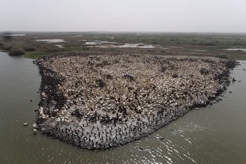
- Faire le comptage d’oiseaux dans le Nichoir des Pélicans.
- Dénombrer des oiseaux dans une zone ne faisant pas partie des secteurs de comptage (le « Lac lamantin ») en raison de son inaccessibilité.
Test de sensibilité:
Les tests de sensibilités des oiseaux aux drones sont appliqués exclusivement aux dendrocygnes, aux pélicans et aux flamants dans le but de savoir l’altitude de vol nécessaire pour les observer sans les effaroucher. Ces tests ont concerné exclusivement les dendrocygnes, les flamants et les pélicans. En utilisant différents types de drones, l’approche consiste à faire un vol stationnaire au-dessus des oiseaux pour enregistrer l’altitude de vol minimale susceptible de causer un dérangement. L’altitude de vol stationnaire initiale est fixée à 50 mètres et est réduite par 10 mètres jusqu’à ce que les oiseaux s’envolent.
Comptage des pélicans:
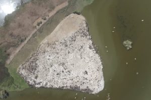
Pour ce qui est du comptage des pélicans, c’est le drone Phantom 4 Pro V2 qui est utilisé et deux approches ont été faites : la première approche consiste à programmer une mission de vol pour cartographier tout le nichoir afin d’exploiter les images orthomosaïques pour la détection. Cette mission de vol a duré 19 minutes et l’altitude est de 50 mètres. La seconde approche a consisté à faire des prises de vue de tout le nichoir pour des besoins d’exploitation. L’altitude de vol pour une prise de vue complète du nichoir étant de 106 mètres.
Zone inaccessible:
Le sujet de l’inaccessibilité des zones est abordé avec l’utilisation des drones pour avoir des images et des vidéos des grandes concentrations de flamants présentes dans le Lac lamantin qui est inaccessible. Il faut dire qu’un magnifique spectacle s’est offert à nous et les images aériennes prises par le drone ont fait l’unanimité.
De retour dans nos locaux à Sénégal Flying Labs, nous avons procédé à l’analyse de ces données par les logiciels tels ATLAS et Picterra pour apporter la preuve qu’au-delà des images et des vidéos, les données collectées ont non seulement apporté de l'innovation dans la méthode de décompte mais ont aussi servi à fournir des chiffres exacts sur les individus présents au Nichoir des Pelicans, au Grand Lac et au Lac Lamatin. Dans notre cas, l’utilisation de ces logiciels a été un exercice très fructueux pour l’équipe.
Senegal Flying Labs, the National Parks Director, and the Directorate of Community Marine Protected Areas have signed a partnership for training and research on new technologies for sustainable management of natural resources and biodiversity conservation. This partnership will allow:
- The development and implementation of training and research program, and active monitoring and bio-ecological strategies;
- Access to scientific knowledge, documentation, publications, and conferences;
- Technical and administrative support; and
- Mutual promotion and participation in relevant exchanges.
A training session for the Ministry's agents took place in January 2020 in Palmarin to introduce drone technology and remote sensing software. To set the foundation for the collaboration, the director of Senegal Flying Labs organized a co-creation workshop. This workshop, conducted on November 11, 2020, at the Ministry of Environment and Sustainable Development of Senegal (MEDD), follows the signing of the partnership agreement and aims to identify the concrete needs of the various technical departments of the MEDD and to see to which degree the use of the drone can provide innovative answers. The preservation of biodiversity requires the identification, quantification, and management of natural heritage and ecosystem services.
 Among the presentations of Sonja Betschart, Tiamiyou Radji, and group workshops, the ministry agents were able to develop projects that will allow them to better measure the drone’s contribution to their work. Furthermore, it was not surprising that Colonel Sidibe, Director of DAMCP, invited the Senegal Flying Labs team for the International Day of Waterbird Counting as an observer to take advantage of the opportunity to validate some theories and approaches.
This demonstrates that the opportunities for using the drone in conservation, preservation of biodiversity, and management of natural heritage are considerable. As soon as the team arrived on site, the officers did not hesitate to mention the importance of Senegal Flying Lab's participation in the international waterbird count to strengthen the analysis capacities of the data collected by drone. Until now, there have been no artificial intelligence tools to identify birds. Moreover, the usual counting methods allow more estimation of the species than their exact count.
 During the journey to Djoudj, the Ministry’s agents weighed the importance of using technology. This was a first in Senegal. It took a lot of methodology and skill for the Senegal Flying Labs team to collect the data by combining drone technology such as the Phantom 4 Pro V2 and the ATLAS AI platform (by SPH Engineering), which is a unique digital platform for aerial image storage, map creation, object detection/counting, and territory segmentation.
The intervention of the Senegal Flying Labs team is mainly focused on solving two major problems concerning the monitoring of waterbirds in the Djoudj National Bird Park (PNOD), which are the reliability of the estimation of large concentrations and the inaccessibility of specific sectors that cause significant numbers of birds to be omitted from the count. In response to these problems, the Senegal Flying Labs team's fieldwork consisted of:
- Testing the sensitivity of certain bird species to different types of drones;
- Conducting bird counts at Pelican Nesting Box; and
- Counting birds in an area not included in the count sectors (the "Lamantin Lake") due to its inaccessibility.
Sensitivity Testing
Tests of the sensitivity of birds to drones were applied exclusively to dendrocygians, pelicans, and flamingos to know the flight altitude necessary to observe them without frightening them. These tests have been carried out exclusively on dendrocygnes, flamingos, and pelicans. Using different drones, we hovered over the birds to record the minimum flight altitude that would cause a disturbance. The initial hover altitude is set at 50 meters and is reduced by 10 meters until the birds fly away.
Pelican Counting
For the pelican count, we used the Phantom 4 Pro V2 for two approaches. The first to program a flight mission that maps the entire “nichoir” to exploit the orthomosaic images for detection. This flight mission lasted 19 minutes, and the altitude is 50 meters. The second approach was to take pictures of the entire “nichoir” for exploitation purposes. The flight altitude for a full shot of the nesting box being 106 meters.
Inaccessible Area
Drones approached inaccessible areas to have images and videos of the large concentrations of flamingos present in the Lamantin Lake, which is inaccessible. What we witnessed was magnificent, and the drone’s photos were unanimously appreciated.
Back in the Senegal Flying Labs offices, we analyzed these data using ATLAS and Picterra to prove that beyond the images and videos, the data collected brought innovation and accuracy to the counting method at the Nichoir des Pelicans, the Grand Lac, and the Lac Lamatin. In our case, the use of this software has been a very productive exercise for the team.
Category(s)
Recent Articles
View All »

Wildfire Assessment and Web Application in Sao Paulo
