Senegal Flying Labs and IPAR Empower Government Institutions to Use Drones for Social Good
Participants left the training fully equipped and energized to apply it to their specific areas of expertise.
June 19th, 2019

Building on the success of the co-creation sessions we held this past February in Dakar, Senegal Flying Labs and WeRobotics partnered with IPAR to train local government officials on the use of drones in mapping and in data collection on May 13 - 18. This training was designed around a firm belief that the sustainable application of drones for social good, from humanitarian aid to development to environmental protection to urban planning to agriculture, begins with a solid understanding of the technology, its strengths, and its limitations.
Senegal Flying Labs has been pleased to see a growing recognition on the usefulness of drones in the country, and that more and more development actors across sectors are expressing an interest in this new technology and acknowledging its many applications. However, there still remains plenty of work to be done across West Africa to promote understanding, and Senegal still lacks legislation to protect and regulate drone usage. That is why Senegal Flying Labs and its partners are hosting training sessions for government officials to fully educate them and their institutions on robotics and Artificial Intelligence and how these technologies can be used to address local and regional challenges.
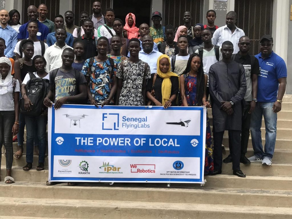
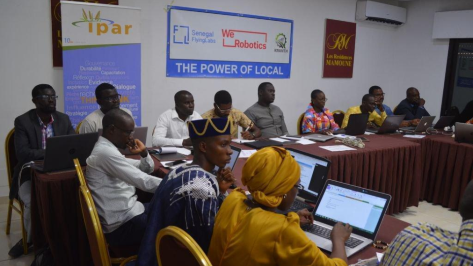
For five days, more than 25 participants from government institutions gathered in the capital for an intensive training led by WeRobotics' Joseph Muhlhausen,with local support from Senegal Flying Labs’ Director Tiamiyou Radji. Government agencies represented included the Ministry of Agriculture,the National Agency of Territory Planning (ANAT),the National Agency of Civil Aviation and Meteorology, the Ecological Monitoring Center (CSE), the National Agency of Statistics and Demography (ANSD), the Directory of Planning and Environmental Watch (DPVE), the Directory of the Environment and Classified institutions, the Operational Office for Monitoring the Emerging Senegal Plan (BOS), and the Ministry of Environment and Sustainable Development. Also represented were the office of the Mayor of Dakar, Cheikh Anta Diop University, and the African Institute for Mathematical Sciences (AIMS), as well as several of our colleagues from Benin, Côte d’Ivoire and Cameroon Flying Labs, who had traveled to Dakar to contribute their own expertise to the discussion.

The course was designed to not only teach the participants how to collect drone images, but to give them the insight necessary to translate this knowledge into real action and impact. The first three days of the training were dedicated to covering all aspects of drone operations, from drone security to professional mapping techniques, and to planning a mission using Pix4D Capture and WeRobotics operational templates and checklists. The course also focused on risk management and practical risk assessment, and touched on topics from the definition and manipulation of vectors, to 3D datasets, to actionable data in policymaking. The participants conducted a mapping exercise using the DJI Phantom sand were introduced to the new Parrot ANAFI, which were used to film the exercise. They also participated in a group exercise to examine real-life case scenarios by following the code of conduct. By the fourth and fifth days, the trainees were analyzing and interpreting the images they had collected with the help of data analytics tools. Unfortunately, on the final day, flight practice had to be postponed due to high winds. However, this turned out to be a learning opportunity, as well as a real life application of the theory section covered earlier in the week. For the participants, it highlighted the need for professional standards and increased training to ensure that drones are flown safely.
A participant from the National Agency of Statistics and Demography (ANSD) was surprised that drones could provide them with such essential aerial data for their daily work.
Our partners left the training fully equipped and energized to apply it to their specific areas of expertise. For example, ANAT explained that it would hugely enhance their work by helping them cut costs and get the data they need without having to go through the expense and difficulties of obtaining satellite data and imagery. Meanwhile, a participant from the National Agency of Statistics and Demography (ANSD) was surprised that drones could provide them with such essential aerial data for their daily work. Following the training, the Ministries of Agriculture and the Environment are now looking into complement their current data collection systems with drone mapping. It has been a pleasure to see our partners take the skills they learned at the training and use them to improve and augment their work in the real world!
We wish to thank our partner @IPAR_ThinkTank for supporting our work in connecting us with government institutions and funding part of the activity. Follow this link to enroll in our next course and join our community to receive updates on upcoming courses and events.
Category(s)
Recent Articles
View All »

Wildfire Assessment and Web Application in Sao Paulo
