Peru Flying Labs Monitors The Peruvian Jungle In A Project That Contributes To Reforestation
Peru Flying Labs surveys more than 6,000 hectares of Amazonian land to assess the damage caused by illegal logging.
July 5th, 2022
The Peruvian jungle is being besieged daily by people dedicated to illegal logging. For this reason, the extensions of forests have diminished immensely throughout the years, increasing even more in recent years.
The study of deforestation is quite difficult due to the remoteness of the areas, the practically non-existent security in them, and the existence of unscrupulous groups of people who only seek the exploitation of natural resources without caring about their impact generated on the ecosystem.
Thanks to the alliance established with UAV del Peru, a Peruvian company with extensive experience in drone operations. Peru Flying Labs was able to participate in a project to determine the damaged cause by illegal logging through the use of drones for BVLOS flights for Refinca, a company dedicated to responsible and sustainable reforestation to mitigate the greenhouse effect based in the Ucayali region.
Peru Flying Labs, hand in hand with a UAV from Peru, were able to carry out the photogrammetric survey of more than 6,000 hectares of Amazonian land using a long-range UAV. This work aims to make the recognition and surveillance deforested areas and the indigenous populations in these spaces.
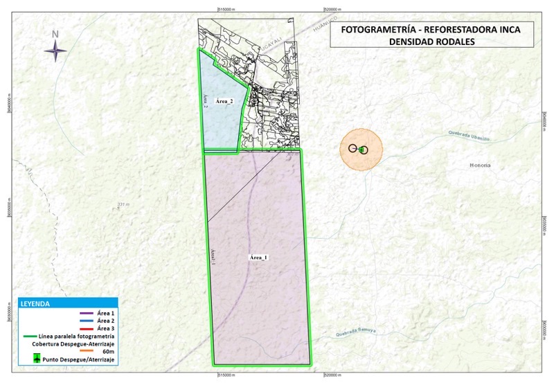
 Planning of the operation in global mapper. The division of the flight areas can be visualized.
This project was carried out for five days. Our team traveled more than 1 hour and a half from the nearest city to the thick Amazon to carry out the mission. The use of long-range aircraft facilitated the work from a safe and remote area, with the farthest point from the take-off area being located 20 km away. This increases the efficiency of the work and reduces the risks of the people supporting this initiative.
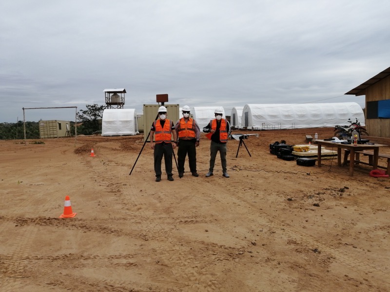
 Our team of pilots and flight technicians ready to start the mission.
The multiple images captured with the sensors installed in the aerial vehicles allow, for example, to calculate the density of trees per hectare. In addition, processing them will help find the spaces and populations most affected by illegal activities and make decisions to reestablish the flora on this remote side of Peru, where many people feel forgotten.
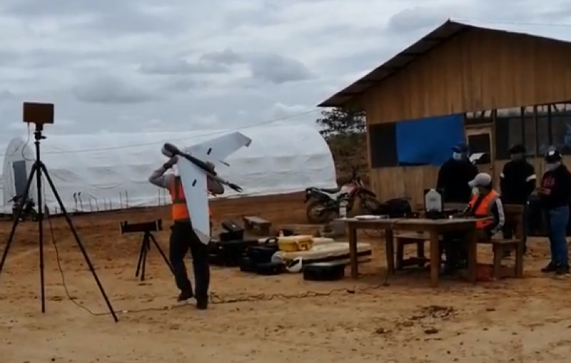
 Flight technician preparing the aircraft for take-off.
With the information obtained, it is intended to plan the reforestation of these areas with eucalyptus and olive trees in a sustainable manner and without affecting the inhabitants' lives in such a way that, in addition, it contributes to the repopulation or establishment of tree or shrub species, native or exotic, for production, protection or provision of environmental services. Furthermore, provide support and encourage the population to join the initiative to consolidate this activity as the main one in the region and thus generate formal and decent employment. "We will be the pioneers in giving sustainability in the country to a first-level technological industrial complex," Refinca quoted.
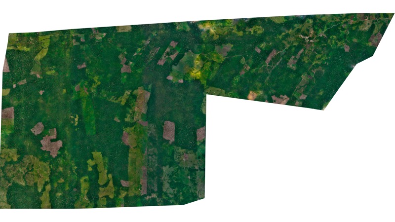
 Orthomosaic obtained from the processing of the captured images.
The work carried out in this project is proof that initiatives committed to the environment exist. We thank Refinca for having placed their trust in us. The fight is continuous, and we are delighted to be part of it. Observing the damage caused by our species closely is very impressive. Therefore, our commitment to projects of this type has always been firm.
Category(s)
Location(s)
Recent Articles
View All »

Wildfire Assessment and Web Application in Sao Paulo
