Peru Flying Labs Helps Improve Disaster Management in View of El Niño Comeback
Peru Flying Labs gathered information with drones, assessing terrain composition, topography of the built areas, and type of construction materials used.
November 27th, 2018

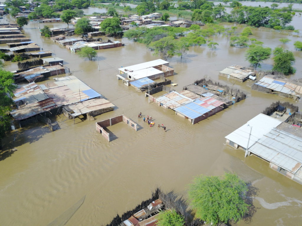
El Niño, fenómeno o evento climático relacionado con el calentamiento del océano Pacífico, provoca intensas lluvias causando desbordes, inundaciones y aluviones, afectando principalmente a las regiones costeras del Pacífico en América del Sur. Perú se vio afectado por este fenómeno a finales de 2016 y principios de 2017, y se espera que se repita el próximo año 2019.
El Instituto Nacional de Defensa Civil (INDECI) publicó un reporte que muestra los efectos del Niño hasta la fecha en Perú. Este muestra un total de 101 fallecidos, 353 heridos, 19 desaparecidos, 141000 damnificados y casi un millón de afectados a nivel nacional desde diciembre del 2016.
Todas estas cifras son el resultado de una mala prevención y gestión de desastres en las zonas impactadas por el desastre.
Hoy en día, gracias a los avances tecnológicos, se puede obtener información del estado actual del terreno, que los organismos pertinentes pueden utilizar para realizar los análisis necesarios para buena prevención y gestión ante futuros desastres naturales.
El Instituto Nacional de Defensa Civil (INDECI) se puso en contacto con Perú Flying Labs para obtener información a través del uso de drones de diferentes zonas vulnerables a este fenómeno, ya sea por el material del terreno donde se encuentran, por la topografía del terreno donde se ubican las construcciones o por el tipo de material de las mismas.
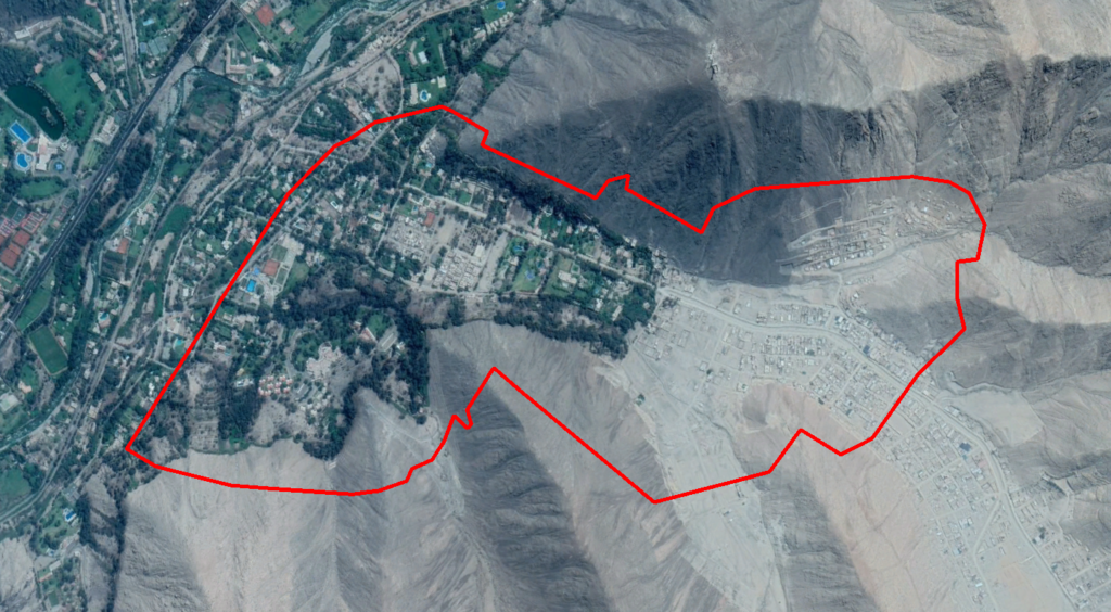
La primera zona estudiada se llama California (Chaclacayo – Lima). Por la topografía del terreno, esta zona es muy propensa a fuertes aluviones o huaicos e inundaciones en las márgenes de las quebradas. En dichos márgenes del río, hay numerosas construcciones, y pese a ser una Cuenca inactiva durante gran parte del año, cuando se producen intensas lluvias, el agua busca su cauce, arrastrando todo a su paso y arrasando con lo que se encuentra.

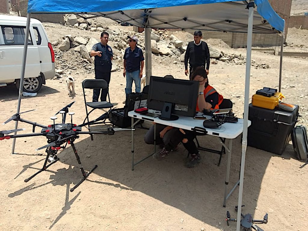
Parte del equipo de Perú Flying Labs sobrevoló dicha zona a principios de Noviembre de este año, utilizando diversos equipos. Con la información procesada que Perú Flying Labs entregará a INDECI, serán capaces de crear rutas de evacuación, localizar las zonas más seguras y estimar un escenario de peligro inminente ante la llegada del Niño del próximo año, para analizar qué zonas se verían más afectadas y así poder tomar las acciones oportunas.
Llevando a cabo las acciones correspondientes, los efectos del próximo Niño podrían ser mucho menores que los producidos el año 2017.
Utilicemos la tecnología para salvar vidas!
El Niño, a climatic event related to the warming of the Pacific Ocean provokes intense rains, causing overflows, floods and heavy rainfall that affect mainly the Pacific coastal regions in South America. Peru was affected by this phenomenon at the end of 2016 and at the beginning of 2017, and is expected to be affected again in 2019.
The National Institute of Civil Defense (INDECI) published a report showing the effects of El Niño in Peru to date. Said report shows a total of 101 deceased, 353 injured, 19 missing, 141000 victims and nearly 1 million affected nationwide since December 2016. These figures are the result of poor disaster prevention measures and management in disaster-hit areas.
Nowadays, thanks to technological advancement, information can be obtained from the current state of the land, which relevant agencies can use to carry out the necessary assessment for better prevention and management in view of future natural disasters.
The National Institute of Civil Defense (INDECI) reached out to Peru Flying Labs in order to gather information with drones in different areas subject to this phenomenon, either through terrain composition, topography of the buildings' areas or type of construction materials used.

The first area to be analyzed was "California" (Chaclacayo – Lima). Due to its topography, the area is very prone to strong rainfall or mudslides, and floods at the margins of the rivers. There are numerous buildings on the riverbanks, and despite the area is an inactive basin for most of the year, when intense rains do occur, water looks for its channel, dragging and destroying everything in its path.
Part of Peru Flying Labs' team flew in early November this year with various drones. By using the processed information that Peru Flying Labs will deliver, INDECI will be able to create evacuation routes, locate the safest areas, predict dangerous scenarios before the arrival of El Niño next year, and identify areas that could be more affected in order to plan appropriate actions.
By taking these steps, the effects of the next wave of El Niño may be weaker than the ones produced in 2017.
Let's use technology to save lives!
Category(s)
Location(s)
Recent Articles
View All »

AfriGEO 2025: How Senegal Flying Labs is Helping Shape Africa's Geospatial Future
