Geography Awareness Week 2023 at Jamaica Flying Labs: Bridging the Digital Divide
Jamaica Flying Labs participated by sensitizing students about the wonders of GIS and UAVs and taking part in the national GIS Day celebrations.
January 16th, 2024
In November 2023, Jamaica Flying Labs celebrated Geography Awareness Week, which was held this year from November 12th to 18th. Geography Awareness Week is an annual celebration in November each year and is dedicated to highlighting the importance of geography as a discipline and its relevance in understanding the world and its complex systems, including physical landscapes, environmental processes, and economic patterns. Jamaica Flying labs participated by sensitizing students about the wonders of geographic information systems (GIS) and unmanned aerial vehicles (UAVs). The team visited three schools in St. Catherine Jamaica and also participated in the national GIS Day celebrations on November 15th, 2023.

School Engagements
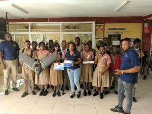
At Charlemount High School, a group of 50 enthusiastic students were immersed in the fascinating realms of GIS and UAVs. The introduction to these cutting-edge technologies shed light on their transformative impact across various sectors, such as geography, environmental sciences, and urban development. Additionally, the students gained insights into the significance of drones in gathering valuable data within their own communities. A highlight of this session was the live drone demonstration, offering many of the students their first-ever experience of witnessing a drone flight in person. This hands-on exposure not only educated them but also sparked their curiosity and interest in these modern technological tools.
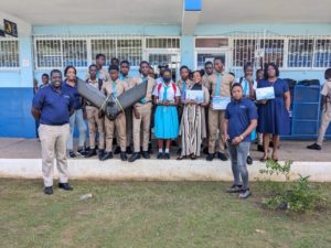
Our journey then led us to Ewarton High School, where 34 students eagerly participated in interactive sessions designed to explore the practical uses of UAV technology. These sessions were tailored to demonstrate how drones could be relevant and beneficial in their everyday lives and potential future career paths. The real-world applications we shared fostered an understanding of how UAV technology is not just a futuristic concept but a tangible, useful tool in various professional and personal scenarios. This experience was instrumental in connecting the theoretical aspects of technology with practical, everyday uses, thereby enhancing the students' appreciation and understanding of UAVs.
The visit to McGraw High School was a memorable one, where 35 students were captivated by live demonstrations of drone technology. These sessions were designed to be both educational and motivational, revealing to the students the extensive range of opportunities that such technology presents. Through these demonstrations, the students were able to witness firsthand the capabilities and potential applications of drones. This experience not only provided them with a deeper understanding of the technology but also inspired them by showcasing the myriad of ways in which drones can be utilized in various fields and aspects of life, opening their minds to the endless possibilities of technological innovation.
 GIS Day at the University of West Indies, Mona
The culmination of our activities was marked by participating in the National GIS Day celebrations on November 15th, organized by the National Spatial Data Management Branch and Land information Council of Jamaica and hosted at the University of West Indies, Mona. This significant event, now in its 21st year, drew an impressive crowd of over 1,000 students, underscoring the burgeoning interest in GIS among young learners.
During this event, Jamaica Flying Labs set up an interactive booth that quickly became a focal point for attendees. This booth offered hands-on drone demonstrations, allowing students to experience the technology up close. Additionally, the booth served as a platform for insightful discussions and presentations on the diverse applications of GIS. The enthusiasm and curiosity displayed by the students were commendable, and the team from Jamaica Flying Labs was delighted by the overwhelming response. Our booth not only educated the attendees but also fostered a deeper appreciation for the potential of GIS and UAV technologies in shaping our world.
Bridging the Digital Divide: The EduTechAid Partnership
A highlight of the week was Jamaica Flying Labs' partnership with EduTechAid, which focused on bridging the digital divide. In a generous initiative, 12 tablets were distributed to students during school visits and at the GIS Day event. This effort was aimed at enhancing digital literacy and providing students with the tools needed to explore and learn about new technologies.
 The Impact
The participation of Jamaica Flying Labs in Geography Awareness Week marked a significant stride in our educational outreach efforts. By engaging with hundreds of students across various schools, our team played a pivotal role in igniting a passion for GIS and UAV technologies in the next generation. This enthusiasm was reflected by the fact that many students expressed a keen interest in forming a youth drone club, a project that Jamaica Flying Labs is excitedly considering for launch in 2024.
Furthermore, the distribution of tablets during this week was more than just a gift. More than just a contribution to the students’ educational resources, the initiative was a step towards bridging the digital divide, providing equal opportunities for learning and exploration in the digital world. The gesture is but a small step but it symbolizes our commitment to fostering digital equality and accessibility for all students.
Going by the positive feedback from students and educators alike, which has set the stage for future events and collaborations, Jamaica Flying Labs' participation in Geography Awareness Week 2023 was a resounding success. While our efforts in narrowing the digital divide represent just one step in a much larger journey, we are optimistic that this progress will contribute significantly to fostering a future where these bright young minds are more technologically proficient and have equal opportunities in an increasingly digital world.
Recent Articles
View All »

Team Cameroon's Road to Victory at the First Global Robotics Competition 2025
