Drones Bring New Hope for Urban Planning in Benin
Through a pilot project, Benin Flying Labs explores how drones can be used to update existing town maps in the commune of Dassa and address local issues.
March 6th, 2019

In many African countries, local services in charge of urban planning often rely on outdated maps and data for their work. This might affect the quality of services they provide their constituents with. Indeed, for efficient allocation and use of land and public domain urban planners should use the latest and most accurate data.
Benin Flying Labs, supported by Global Partners and Agence pour le Developpement du Numerique (ADN), conducted a pilot project on the use of drones for urban planning in the commune of Dassa, in the department of Collines. The project aims at examining how drones can be used to update existing maps of the town and address local issues. Through this pilot project, Benin Flying Labs also aimed at providing evidence to the commune on how data collected with drones can be leveraged to make efficient tax collection by creating accurate and easily updatable databases of the houses in the town, tax collection being by levied on houses.
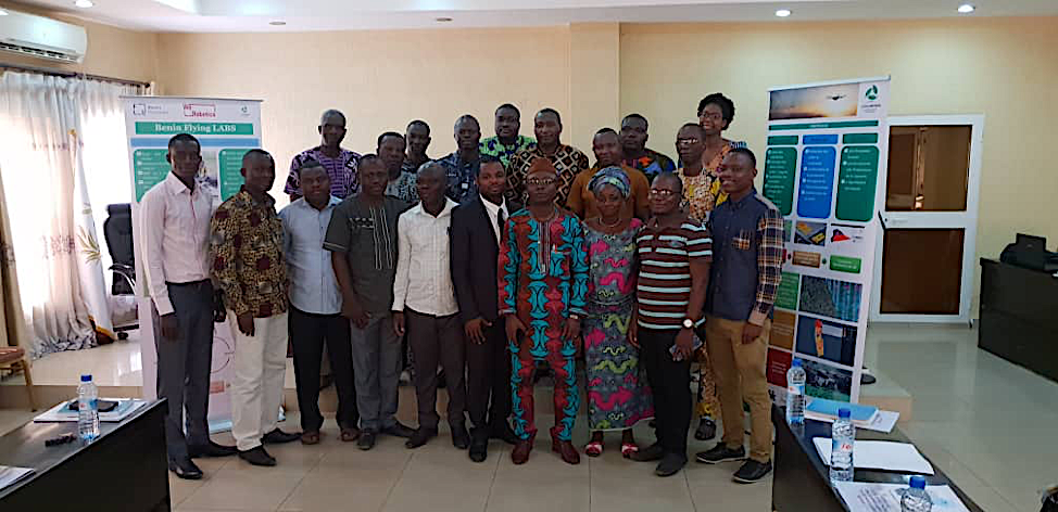
On October 21 - 24, 2018, the team involved in the project in Dassa conducted a workshop with different stakeholders to engage the community, identify their need and address them when analyzing the data. Another workshop was conducted on October 22, 2018 to present the results to the community. Participants to the workshop were representatives of the neighboring communes in the department of Collines.
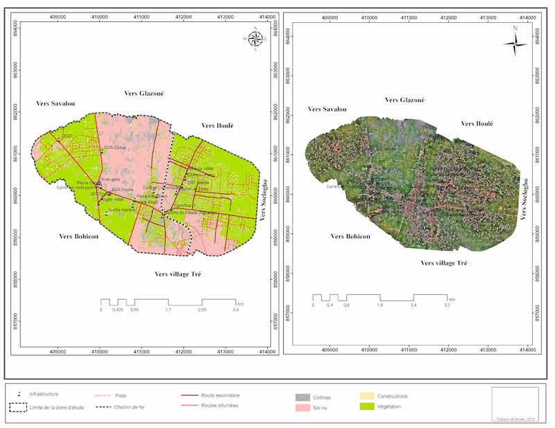
 Figure 1 : Comparison of orthomosaic map with map derived from supervised classification of the orthomosaic (low scale)
Results presented during the workshop show concrete applications of how the maps obtained could be used to address issues related to infrastructures management, the evolution of the vegetation, arable lands, and soil erosion, localization of residential waste deposits and their environmental and health impacts, etc. Participants were also able to identify a sample of important infrastructures and habitations in the town.
During the workshop, a collaborative exercise between the participants and the team of Benin Flying Labs examined how the houses can be located, delimited, and entered into a database. Using ArcGIS this participatory mapping exercise was one of the preferred activity of the participants. A policy exercise invited participants to identify the constraints they might face that can limit the use of drones in their communes and share with the team their recommendations. Some of the constraints identified are:
- Lack of technical competencies at the local (communal level) for drone operations
- Prohibitive cost of acquisition of hardware and software for data processing
- Drone regulations which limit its development and use for good
- Lack of engagement of local authorities in adopting the technology
- Reduced drone autonomy
To address these challenges, the participants recommend that Benin Flying Labs conducts an awareness campaign directed towards the communal councils in all the communes in the department of Collines. The campaign will help present the results of the pilot project and conduct other pilot projects specific to the issues faced by each commune. They also recommend that Benin Flying Labs conducts training at the local level instead of the capital city, encouraging the review of drone regulations to create an enabling environment for the use of drones for good.
Category(s)
Location(s)
Recent Articles
View All »

Wildfire Assessment and Web Application in Sao Paulo
